Tag Archives: Ramapo-Dunderberg Trail

And The Winner Is…The Rocks!

IMG_6651_edited

There once was a guy named Mike,

And boy did he like to hike.

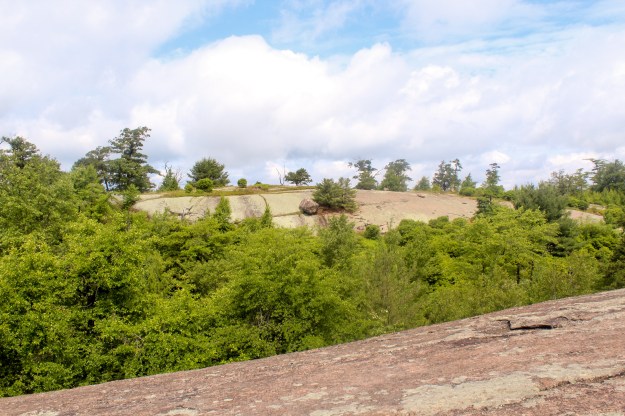
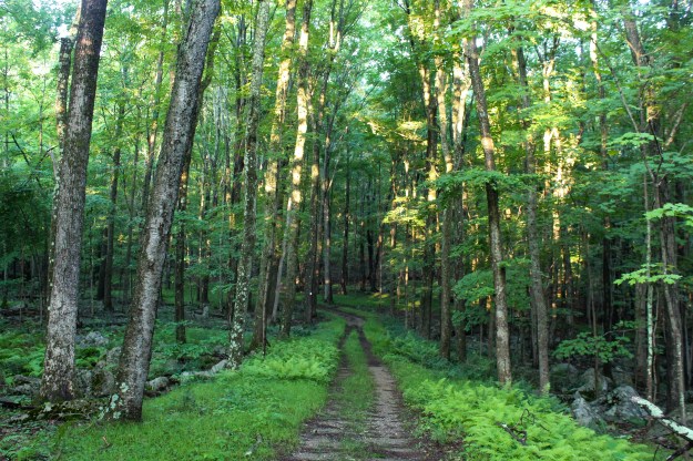
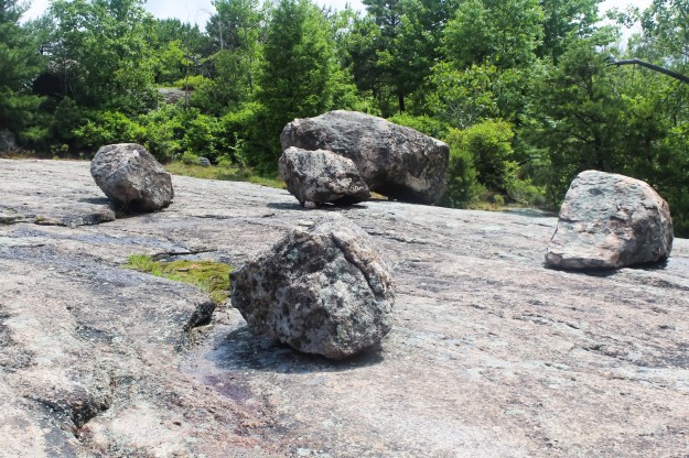
Into the woods and onto the trail,

Walking and walking so he could tell a good tale.

Then came that morning, on a hot day in June,

When he strapped on the pack and it ended too soon.

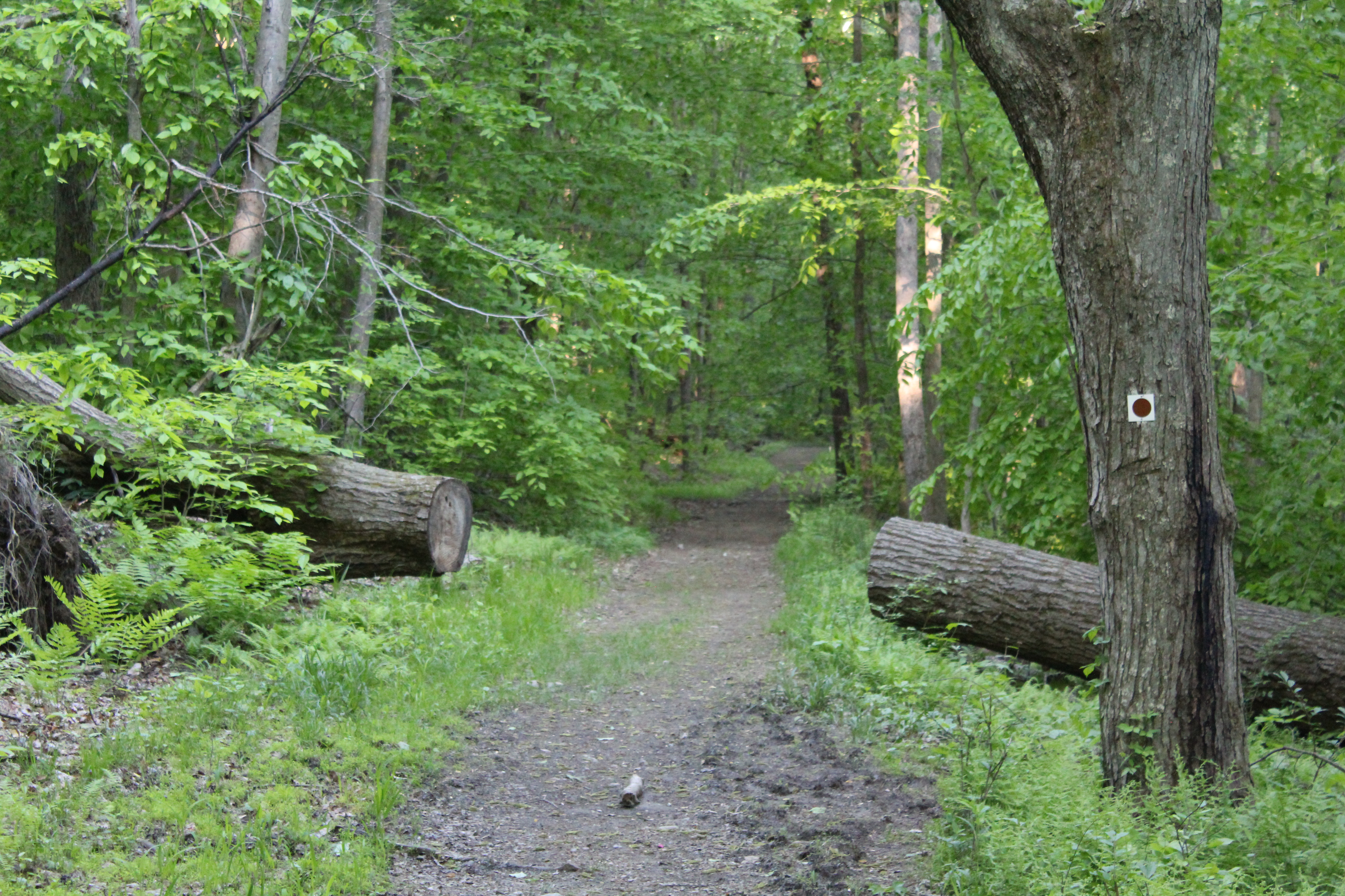
The rain had come heavily, the whole night before,

It seemed that the rocks had to settle a score.

As he walked on those rocks, and he breathed in the air,

The hiking was good, and he had not a care.

Then all at once, he started to slide,

With nowhere to run and nowhere to hide.

His foot then then got caught and he heard a strange snap,

Oh what had happened? Was it some kind of trap?

As he lay on the ground, the situation was grim,

He knew it was bad, his head started to swim.

One short week later, after the surgery was done,

It was obvious and true that the rocks, they had won.

Happy Hiking!!!


Day Two-Trouble Ahead!

Knowing that water may be hard to come by for the nine mile hike on day two, my hiking partners rigged up a pretty simple water containment system to catch as much water as possible. Over night we did have several hours pouring rain and thunderstorms which made capturing the water that much easier.

When all was said and done, we collected and purified around 5 gallons of nice cold water!

IMG_6646_edited

Collecting water at the Bald Rocks Shelter.

Now the fun begins! Leaving the shelter at around 10 am, we got back on the Ramapo Dunderberg trail and began our day! The terrain in this part of Harriman is just spectacular. Geologists believe that millions of years ago this area of New York may have been part of South America. It always amazes me that rocks end up where they do and stay there!

IMG_6650_edited

Beautiful scenery a half mile into the hike.

IMG_6651_edited

A couple of tenths of a mile from disaster!

IMG_6652_edited

Although the rocks shown in these pictures are dry, when you got the end of one and it turned back into trail, the rock proved to be very slippery.  As I was coming down off of the rock in the third picture from the top, I began sliding and I lost my balance. My left foot became wedged between two rocks as I stopped, my forward momentum kept me moving.

End result? A fractured left ankle and a subsequent surgery to repair it.

Happy Hiking!!!

Hike #21-.9-117.85

Ramapo-Dunderberg Day One

The start of the my short shakedown hike (6/27) was as humid as you would expect for the end of June in New York. Temperatures in the mid 80’s with humidity almost equally as high guaranteed an early soaking. Since my son had a job interview that morning, we had him drop us off at the Tuxedo RR station at 6:30 am.  Starting early would also put us ahead of the heat and the humidity. The station marks the start of the Ramapo-Dunderberg Trail.

IMG_6603_edited

The view after the first climb.

The plan for the day was a simple one. Hike just a little over six miles and then spend the night at the Bald Rocks Shelter. Even though it was only six miles, I hadn’t hiked with a full pack in awhile and coupled with difficult terrain and weather, it was a long day. According to our GPS, we gained just about 1500 feet of elevation! Obviously the views were great.

IMG_6612_edited

IMG_6613_edited

IMG_6616_edited

The Bald Rocks Shelter is an interesting one.  This blurb was taken from MyHarriman.com:

  • Bald Rocks (Ramapo-Dunderberg Trail).  Massive local granite stones make up his walls, with a nice fireplace inside and a firepit outside.  The surrounding area is grassy, with trees close enough to allow hammocking, but not too tight to make you feel like you’re in the woods.  Because you’re not — you’re in a lovely grassy field on top of a hill. Great views, too!  The trails you’ll use to get to Bald Rocks are some of the best in the park, too, and you’ll be camping near some of Harriman’s coolest sights: Bowling Rocks, Ship Rock and the spine of Hogencamp Mountain.  Nice.
IMG_6622_edited

The Bald Rocks Shelter

IMG_6633_edited

Inside the shelter

IMG_6642_edited

The fireplace inside the shelter.


Happy Hiking!!!

Hike #20-6.25-116.95

Keeping It Light Until The Time Is Right

“Hike more, worry less,”

-Anonymous

Today was the first hike of the summer break!!! I am going to keep the distance short today and tomorrow since I will be out backpacking Wednesday, Thursday and Friday on the Ramapo-Dunderberg Trail. Twenty three miles of fun on the trail!

With that said, this morning it was pretty humid and you could tell that the thunderstorms that rolled through last night had dumped a ton of rain on the trails.

Even with the humidity it was still nice to get out and get a hike in. I’m looking forward to our trip to Harriman!

Here are some photos from this mornings hike:

IMG_6589_edited

A stretch of the Leatherman’s Loop that was especially beautiful today.

IMG_6590_edited

A stream that runs underneath the trail.


IMG_6591_edited

Same stream as above.

IMG_6592_edited

A connector trail just before the Red Trail.

Happy Hiking!!!

Hike #18-4.7-106.6

Shakedown #1-Ramapo-Dunderberg

app trail blog image_edited

A while back I made a decision that when I retired I would hike the Appalachian Trail. Even though it is almost two years away, I am glad that I have that time to plan for this six month adventure. As I have watched videos of thru hikers, I have come to one conclusion. You have to know what gear you need/want and you have to know whether it works for you or against you.

On Wednesday of next week I will be heading out to Harriman State Park with two friends to backpack the Ramapo-Dunderberg Trail. Running a little over 21 miles, the trail begins at the Tuxedo RR station and ends on route 9W on the opposite side of the park.

I am considering this my first shakedown hike in preparation for the AT. A shakedown hike is described by Brian Lewis as a “…longish backpacking trip where you try out your gear and associated process to find out if there are things you can improve (in either) before your thru-hike. And hopefully it will also confirm that hiking somewhat longer distances is something you really want to do.” My first shakedown will be three days and two nights.

Will I like the gear that I have? Will I want to do another trip, maybe longer before I make any final decisions? I don’t know. Only time will tell!

Over the next few days I am going to post some of the new gear that I have as well as the tried and true that I am pretty sure I will use on the AT.

Please feel free to leave your comments!

Happy Hiking!!!

Please read more about shakedown hikes here:

https://thetrek.co/why-shakedown-hikes-important-new-backpackers/

https://thetrek.co/appalachian-trail/shakedown-hike-gear-review/

https://sectionhiker.com/shakedown-hikes-arent-just-for-backpacking-beginners/

Horn Hill Bike Path X2-Walking Meditation

“The mind can go in a thousand directions, but on this beautiful path, I walk in peace. With each step, the wind blows. With each step, a flower blooms.”

-Nhat Hanh
“Walk as if you are kissing the Earth with your feet.”
-Nhat Hanh
“Walk so that your footprints bear only the marks of peaceful joy and complete freedom. To do this you have to learn to let go. Let go of your sorrows, let go of your worries. That is the secret of walking meditation.”
-Nhat Hanh


Last summer I did a whole bunch of hikes from a book called, Circuit Hikes In Harriman by Don Weise. Today (4/11/17), I was going to do a pretty lengthy hike but when my daughter asked if she could go hiking again today (WOW!!), I decided to do this relatively easy loop in Harriman State Park.

Once again, the difference in what the woods look like from season to season is truly amazing. Five and a half miles later, I think that I got some pretty decent photos.

IMG_6208

The start of the Horn Hill Bike Path. Nice and flat!

IMG_6213

IMG_6218

Canada Geese feeding a pond next to the trail.

IMG_6219

The same geese…

IMG_6225

Trees along the trail.

IMG_6226

The Appalachian Trail crosses this trail at two points during the hike.

IMG_6227

The AT headed south towards Georgia.

IMG_6232

IMG_6245

Looking south behind us on the trail.

IMG_6247

As you hike along the bike path, the Ramapo Dunderberg Trail crosses its path. Here are some nice stone steps to help you on your way.

IMG_6250

Beechy Bottom Road


For Your Viewing and Hiking Pleasure-The Cornell Mine Trail->Bald Mountain

“The mountains are calling and I must go.”
-John Muir
“Because in the end, you won’t remember the time you spent working in the office or mowing your lawn. Climb that goddamn mountain.
-Jack Kerouac
IMG_8520
My love hiking in the Hudson Valley is well documented. One of the things that you will learn about hiking here, however, is that many of the hikes in this area start with a long, lung busting and thigh searing climb. This is a given. Some of them happen to be mildly torturous  and some of them make you wonder why you are hiking there in the first place. But remember, with these sometimes murderous climbs (perception is everything), the payoff of a magnificent view makes it all worthwhile.
My friend Jaime and I decided to meet pretty early on the 4th to do a hike in Bear Mt. A nice loop in the area is the Cornell Mine Trail to Bald Mt. and then down and out through Doodletown on Pleasant Valley Road. Parking proved to be pretty easy as we both found space to park just across from the trail head and around 50 yards from the entrance to Iona Island.
IMG_8623
IMG_8532

The Bear Mt. Bridge as seen from sea level at the parking area on Route 9W.

IMG_8531IMG_8517
As you cross 9W and enter the woods, the trail immediately turns to the left and then you begin a relatively steep climb. Don’t worry, because after about ten minutes, the trail levels off and you are able to catch your breath as you continue to move steadily towards the most serious climb of the day.
IMG_8536

Jaime on the Cornell Mine Trail-I’ve been hiking with this guy for over twenty years!!!
IMG_8539


IMG_8541
As you hike towards Bald Mt., you will notice that the terrain is pretty diverse in regards to what it has to offer. At one point you may be hiking on what appears to be a well manicured trail, and on others you will have to keep your eyes on the ground in front of you due to large amount of loose rocks laid out in front of you.
After a little more than a half an hour of hiking, you’ll notice the huge and imposing figure of Bald Mt. directly ahead of you. Even though it looks much more imposing during the winter months when the trees have no leaves, even now you certainly know that it is there, waiting for you. Trust me, it is going to suck the life out of you if you let it! As you approach this part of the climb, it appears relatively flat. Don’t be fooled by this because the most challenging part of the climb awaits you. The trail quickly begins a steep and unrelenting climb up to the view-point. To ease the pain, you will find some switchbacks on the first part of the climb that offer a modicum of relief. Remember that you will be climbing a vertical distance of 500 feet in less than half a mile.
A quick word of caution to all hikers regardless of experience-The footing on this, the most difficult part of the hike, is pretty treacherous. Please be very careful based on the fact that loose dirt and rocks combine to make for what could be a bone busting experience!
After you have climbed about 80% of the mountain, the trail will take a very sharp left. Before you head up and finish the Cornell Mine Trail, turn around for a stunning view of the Bear Mt. Bridge.
IMG_8548
IMG_8549
After soaking in the view and taking a well earned rest, turn back around continue to head the trail. In just a few minutes, The Cornell Mine Trail ends at a junction with the Ramapo-Dunderberg Trail. Make sure that you turn right onto the Ramapo-Dunderberg Trail and continue climbing. Although you are still moving up, it is nowhere near the intensity of the rest of the climb. After leaving the intersection, you should reach the summit of Bald Mt. (Elevation 1,080 feet), in about ten minutes. As you get closer, you will continue straight ahead on an unmarked path to reach the summit. At this point you will have climbed more than 1,000 vertical feet from the start of the hike on route 9W to the summit.


Even though there was some haze in the air, the views were magnificent and I believe that I was able to get some good pictures. To give you some perspective, Anthony’s Nose is the mound on the right side of the bridge.

IMG_8550

Bear Mt Bridge with Anthony’s Nose to the right.

IMG_8551

Bear Mt. Please note the tower about 3/4 from the right.

IMG_8558

Perkins Memorial Tower as seen from Bald Mt.


IMG_8563

IMG_8564

After relaxing for a while, you can take the red on white trail markers on your right and start heading down. Once again, the trail down has some pretty loose dirt and rocks and  with the first descent being quite steep, you might want to be more cautious than you normally would be. After a brief leveling off, you continue heading down the trail, eventually coming to an almost tunnel of Mt. Laurel.

IMG_8565

When you reach the stream, you will make a quick right turn and shortly after that the Ramapo Dunderberg trail continues to the left. For our purposes, we decided that instead of heading to the Timp, we would continue down on a woods road into Doodletown. This woods road soon becomes the 1777 trail.

IMG_8569

As you come down a final small hill, the trail levels off and crosses a stream. To the right, stone foundations and a trail shelter can be seen. You have to make sure that you look quickly because if you aren’t paying attention, you may miss the shelter!

IMG_8567

IMG_8572

As you continue ahead on the woods road, you will soon enter and move through the former settlement of Doodletown. This settlement thrived in this area for two centuries until it was acquired by the park in around 1960. But before you get to Doodletown, keep looking around to make sure that you don’t miss these views.

IMG_8614

IMG_8615

This sign below represents a walking tour sign to help guide you through the area.

IMG_8606

At this point you will have been walking on paved roads and will continue to do so until the hike ends.

IMG_8593

A stone wall from one of the many houses at Doodletown.

IMG_8595

We kept hiking along the 1777 Trail, which is also known as Pleasant Valley Road, and as you make your way down the road, you will pass the remnants of the many homes that formed Doodletown. You will see markers like this all along the trail to show where each of the houses in the settlement were located.

IMG_8579

One of the more interesting sights that you can see in the Doodletown settlement is the remnants of their garbage. Apparently they used to bury their garbage and from time to time, you can see garbage that has “floated” to the top through erosion of the land. A good example is this broken milk bottle:

IMG_8596

 Shortly after I took this picture, the grade of the road dipped steeply and we were back on Route 9W where we started. This is the last sign you will see as you finish the hike and If you decide to do this hike in reverse, it will be the first.
IMG_8621 (1)
The hike ended up being about 5 1/2 miles with just over 1,000 ft in elevation gain. With stopping to rest and taking pictures, it took us about 3 1/2 to complete. Based on its level of difficulty as well as numerous viewpoints and other worthy sights, this is definitely a hike you don’t want to rush through. Take your time to soak it all in, it’s worth it!
Now, with all of that said, although I would never discourage anyone from taking a hike, if you want to take animals small kids on this one, you need to be really careful.The steepness of the climb as well the loose dirt and rock on the climb could prove to be too much for a smaller child or a dog.
Any adults, however, who want to do this hike, I say GO FOR IT!!!!!