Morning sun rises
The quest an obvious one
Peace, tranquility


The sign at the entrance to the parking lot.

“The clearest way into the universe is though a forest wilderness.”
-John Muir
“Hike while you can.”
-Unknown
I’m pretty sure that it’s been over ten years since I did any kind of hike in the Black Rock Forest. Since today was another one of those rare cool mornings in August, I decided to do a loop that would take me over trails and woods roads to places that I have never hiked before. Parking was easily found just off of Route 9W.
Starting on the Duggan Trail, the trail quickly descends through some pretty thick woods that had some interesting rock walls and large rocks as stepping-stones.


After following the red blazes for about a half of a mile, the trail ends and intersects with the blue blazed Reservoir Trail. Since this hike is a loop, you will encounter this trail again, this time going uphill. Crossing a woods road, you immediately come upon Ben’s Bridge, which will take you across a small stream.


Ben’s Bridge

A closer look at Ben’s Bridge.
After crossing the stream, the trail, at this point very rocky with a lot of loose dirt, begins a steep and winding climb that parallels the stream. The trail here was pretty cool because at times it was closed in and you got a feeling as though you were wrapped in a lush blanket of summery goodness.


I also thought that it was great having the sound of running water to distract me from the climb in front of me. Cascading over the rocks, it calmed me and I thought how nice it would be to just be able to sit by the stream and vegetate! On this day, however, I had to keep moving. Most of the time I usually don’t mind steep climbs, but with all of the loose rocks and dirt that made up the trail, it just made it that much more difficult. After steadily climbing for a half of a mile, look to the left and you will see this:


Apparently the reservoirs in the Black Rock Forest still supply water to the local communities and this is one of the pipes that accomplishes that. Directly across from the pipe is this awesome sign that not only tells you what trail you are on, it also lets you know what is coming up on the trail. If only all signs on all of the trails in the area were this detailed!!!

After resting for a few minutes, drinking some water and tightening my boot laces, I threw my pack on and made the right turn up the Honey Hill Trail. This trail also weaved through the woods and after just coming off of the Reservoir Trail it to proved to be a pretty steep climb. Based on all of the write ups I read preparing for this hike, I thought that a nice view was awaiting me when I reached the top! Hmm…I’m thinking that maybe the folks that wrote about the views on Honey Hill did so in the fall or winter because when I got to the top, this is all I saw.

If the trees were bare I do believe that the view would have been much better than it was today. Since I didn’t have t any type of view, I immediately headed down the trail. Be careful here because it is very steep and the terrain mirrors what you have already been hiking on-loose rocks and dirt! Be mindful and watch your footing as you make your way down this section of the trail because the drop off to the right could prove to be treacherous if you slipped and fell!

For our hike, keep heading to the left down towards Aleck Meadow.

Steps on the descent from Honey Hill.
I have to admit that the first thing I thought when I saw this tree was Blair Witch Project. If I had been hiking close to sunset I probably would have started running. Good thing it very early in the morning!!

Blair Witch Project!!!
Staying on the trail, you either descend or stay level for another fifteen or so minutes. As you continue hiking, the sound of running water becomes louder and louder and after rounding a corner, you are presented with this stunning view.

Due to recent storms that had passed through the area just two days before this hike, water was actually flowing over the dam. Based on the time of year, I had fully expected it to be dry. This made up for my Blair Witch like scare just minutes before!

The trail continues right to left over the spillway on the Stillman Trail.

The Stillman Trail

The Stillman Trail after crossing the spillway.

The dam at Aleck Meadow Reservoir

Aleck Meadow Reservoir
I had first decided to make the trek to Black Rock Mountain but after looking at the map I thought it would be cool to venture instead to the White Oak Tree. The tree, conveniently located not to far along on the White Oak Road, was worth the diversion that I had decided to take. How often do you see a huge tree that sits in the middle of a road?

White Oak Tree

You can sit and rest at the White Oak Tree on this bench.
To continue on the Continental Road, do an about face and keep hiking. I know that the Black Rock Forest Consortium uses these roads, but I never thought that I would see this sign:

You will follow this woods road for almost four tenths of a mile where the Continental Road continues straight. Directly to the right, you will see the entrance to the Hulse Road. Continue on this road for the 1.4 miles. As soon as you round the corner in the picture below, you will start to descend rapidly through the forest. At times the descent is very steep so you need to be very careful, the trail here is also very rocky and if you aren’t paying attention you could easily twist an ankle.

After completing the 1.4 mile downhill extravaganza, you will find yourself on the blue blazed Reservoir Trail again. The trail starts moving uphill again, but not at the same rate as the downhill you just completed. Two tenths of a mile after rejoining the trail, you make a left hand turn and you are back on the Duggan Trail. Stay on this for a half of a mile and you are back to where you started!

This small building was just off of the Reservoir Trail after leaving the Hulse Road.

Even though I didn’t get the view I was expecting from Honey Hill and also bypassed Black Rock Mountain, I did get to see the Dam, Aleck Meadow Reservoir and the White Oak Tree. They all proved to be interesting in their own unique ways and I’m glad that I got some pictures on what was a beautiful day. I would love to see the dam when the reservoir is cascading over the top at it fullest and head up Honey Hill when the trees aren’t fully obscuring what I am sure is a magnificent view! It looks like I may be doing this hike a few more times this year to see what I can see. Another excellent hike!!!
Happy hiking folks!!!!
Peace!

“I’ll call if I break a leg or get eaten by a bear.”
“Play like a rock.”
“Now?”
“No, if a bear starts eating you.”
I thought for a moment before replying. “Do they have screaming, sobbing rocks, ’cause that’s probably what I’ll be doing if a bear is gnawing my arm off.”
“It would be difficult to just lay there and be eaten alive, huh?”
“Ya think?”
― Darynda Jones
Well folks, without a doubt, today’s adventure will be in The Zen Hiker’s top two or three hikes of all time. After looking at the weather and seeing a forecast for severe storms later in the day, I decided to get out really early to beat the storms as well as the heat. Leaving my house at 4:00 am, I got to the parking lot at the Bear Mt. Inn at about 4:45. Even though it was cooler than previous mornings, the humidity was still oppressive enough where walking across the field to the trail had me sweating.
Now before I get into why this will rank in the top hikes I have ever done, I have tell you that the work that has been done rerouting the AT from the Bear Mt. Inn to the road (about 3/4 of the way up) is phenomenal. At Hessian Lake they have added a section that is almost like a tutorial for people who may be new to hiking. As you walk through this miniature AT, an old stone building stands guard as you make your way towards the rerouted section that leads to Perkins Memorial Tower.


Bizarre encounter #1- I will call it-“Seriously? A skunk?”
As I walked along the edge of the building, the only sound I could hear was my boots scuffing the ground and the click clack of my hiking poles. Approaching the end of the building, I was getting myself mentally ready for the next two miles that I knew were going to be totally up hill. Without warning, and providing enough of a scare that a string of expletives flew from my lips, a skunk of enormous proportions waddled around the corner. Now if the skunk could have screamed, I am positive that it would have.

To the right of this beautiful old stone building was were the skunk and I had our brief but memorable encounter.
Instead, unintentionally and without malice, I happened to be so close to Mr. Skunk that I kicked it right in the head, scaring the crap out of me as well as my new friend. Obviously luck was with me because as I took off running in one direction, the skunk took off in the other. When I stopped running, my mind was racing because I thought for sure that I had been sprayed and that at any second the not so pleasant odor of skunk would overwhelm me. For whatever reason, be it the shock of the surprise of literally running into each other or just dumb luck, I had been spared the horror and discomfort of the skunks primary defense system. Heading up the trail, thankfully the only somewhat bad odor that I noticed was me.
The work done by the trail crews is really unbelievable. Carefully manicured, the trail led to stone steps that quickly and steeply zig zagged its way up the side of the mountain.


The wonderful thing about the trail now is that although the climb is steep, the space between each step is just about perfect and after each climb, the trail levels off for a period to give you a chance to recover.


One of the things that I wanted to make sure that I captured on this hike was the sun rising from other side of the Hudson. For once, you will be able to see the nose from Bear Mt., instead of the other way around. Something new!

Anthony’s Nose as seen from Bear Mt.
Bear Mt. Bridge and Anthony’s Nose

The morning sky

The whole reason for doing this hike was to get to Perkins Memorial Tower. On any weekend day during the summer (and some weekdays as well), this entire area will be filled with people. Cars fill each parking spot, hikers appear and disappear from the myriad of trails that intersect in and around the area of the tower and the level of solitude is zero. I would not recommend this hike if peace and quiet are what you are looking for.

Perkins Memorial Tower at Bear Mt. Elevation 1284 feet

Bizarre animal encounter #2 which I will call-“Is he really coming after me?”
Ok. Now for more fun stuff. As I was returning back to the Inn on the AT, part of the trail goes down a stretch of road. Since it was still early, the only sounds I could hear were the Metro North trains ferrying the sad masses to the city to their jobs. Shortly after coming out of the woods and onto the road, I heard clapping and yelling. My first thought was BEAR! Since the commotion was coming from the direction I was headed, I slowed down and kept my eyes on the woods. No more than a couple of minutes passed when I looked to my left and saw this:


Granted, this may not have been the biggest bear, but it was a bear nonetheless. Now, in my many years of hiking, I have encountered probably every other type of animal you would expect to see. I have even seen numerous rattlesnakes! But I have never, ever encountered a bear. Not until today. As I snapped the pictures above, I was happy because the bear seemed spooked and was moving away from me. To keep him hopefully heading in a direction away from me, I put my camera away and slowly made my way down the trail. As I did, I noticed my second new friend of the day turn and head directly to where I was walking.

He found his way up to the road and started following me. Needless to say, I wasn’t that thrilled to have a bear stalking me. Of course my mind was now racing again with thoughts on what I would do if he actually came after me. Do I lay down and play dead? Do I yell and make noise like the guy I heard just a few minutes ago? (Obviously whatever he did had him moving directly towards me.) Do I run for my life and hope that he isn’t that hungry? I wasn’t really sure. All I knew was I would rather almost step on another rattlesnake instead of deal with this guy! Luck was with me again as the bizarre cat and mouse game only went on for about fifteen minutes before he turned into the woods again and headed towards the tower.
Was I really that nervous when I initially saw the bear? Not really. My trepidation came when I thought that he had decided to turn me into his next meal. Of course as I think about it now, that probably wouldn’t have happened, but at the time, I was picturing myself being seasoned by my furry friend. Time to get some pepper spray.


Looking north on a hazy morning.
Happy hiking everyone!!!!
Depending on many factors, mornings in the Hudson Valley of New York can present many different pictures. If you live here, you get a daily reminder on how much can change in regards to the views of familiar landmarks on a day-to-day basis. The Hudson Valley is not only aesthetically pleasing, it is also a historical and cultural wonder as well.
Today, the weather was about as perfect as it can get for an August morning with a 5:45 am temperature of 58 degrees and very low humidity. Located off of Route 9D in Garrison, NY, I passed this field on a farm on my way to Anthony’s Nose (yes, again).

Looking into the horizon as the sun was rising, I watched a coyote run across the field from left to right into the woods as I was preparing to take this picture.

A closer view of the farm from the picture above.

A wider view with Castle Rock on the upper right.
You can read more about Castle Rock here: https://en.wikipedia.org/wiki/Castle_Rock_(Garrison,_New_York)

“The clearest way into the Universe is through a forest wilderness.”
–John Muir
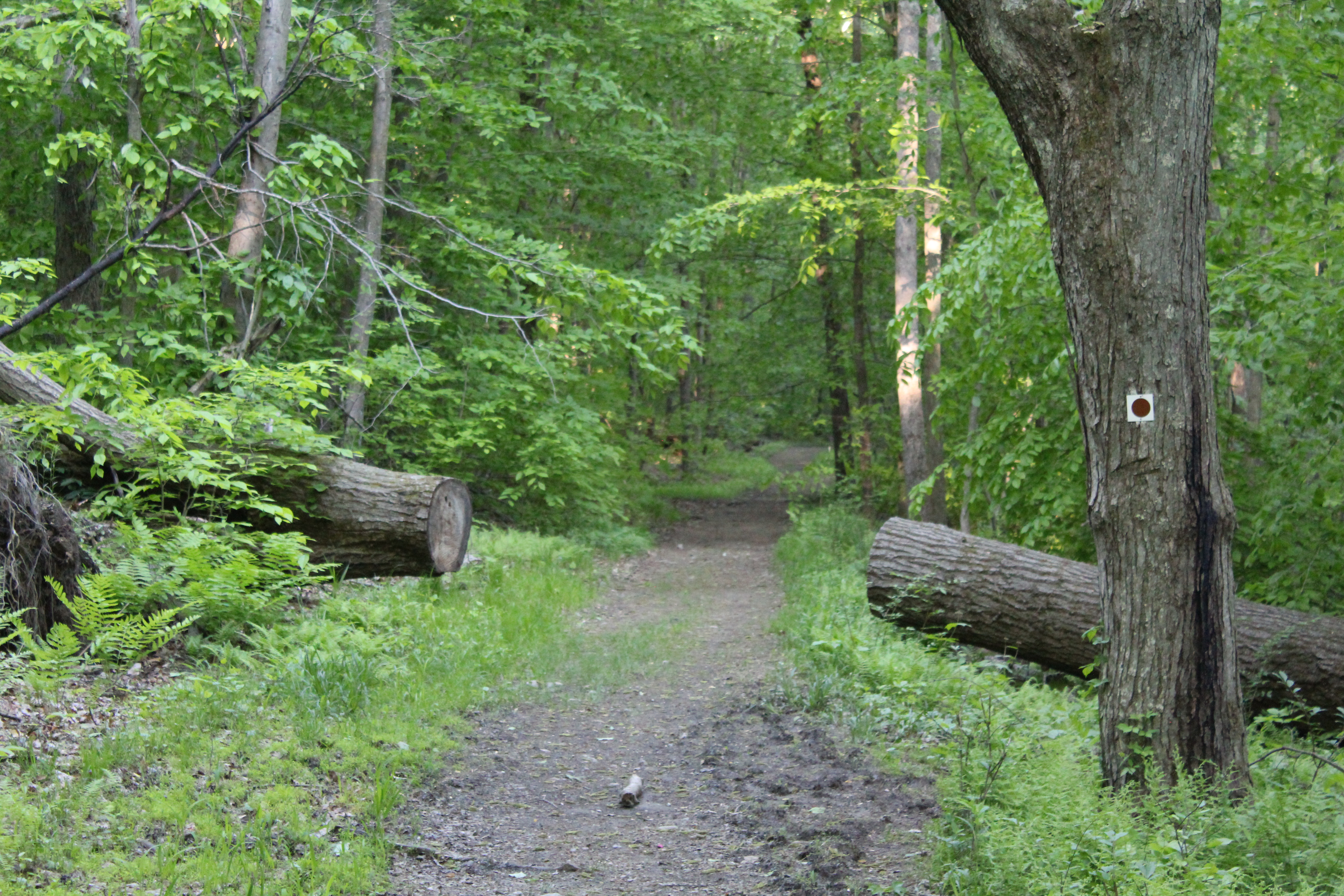
Heading out into the woods anywhere in the Hudson Valley promises each person a wide variety of trails that are naturally built into each hike. Some are wide and can accommodate several people walking shoulder to shoulder, while others, as seen in the photo above must be traveled in a single file. Hiking on narrow trails, especially when they go on for some length, provide you with a sense of not knowing what it going to come next. Will the trail open up? Will it stay the same? When I venture out and encounter long stretches like this, it feels like being wrapped in a warm blanket. Soft, secure and peaceful.


The Bear Mt. Bridge as seen from sea level at the parking area on Route 9W.


Jaime on the Cornell Mine Trail-I’ve been hiking with this guy for over twenty years!!!


Even though there was some haze in the air, the views were magnificent and I believe that I was able to get some good pictures. To give you some perspective, Anthony’s Nose is the mound on the right side of the bridge.

Bear Mt Bridge with Anthony’s Nose to the right.

Bear Mt. Please note the tower about 3/4 from the right.

Perkins Memorial Tower as seen from Bald Mt.


After relaxing for a while, you can take the red on white trail markers on your right and start heading down. Once again, the trail down has some pretty loose dirt and rocks and with the first descent being quite steep, you might want to be more cautious than you normally would be. After a brief leveling off, you continue heading down the trail, eventually coming to an almost tunnel of Mt. Laurel.

When you reach the stream, you will make a quick right turn and shortly after that the Ramapo Dunderberg trail continues to the left. For our purposes, we decided that instead of heading to the Timp, we would continue down on a woods road into Doodletown. This woods road soon becomes the 1777 trail.

As you come down a final small hill, the trail levels off and crosses a stream. To the right, stone foundations and a trail shelter can be seen. You have to make sure that you look quickly because if you aren’t paying attention, you may miss the shelter!


As you continue ahead on the woods road, you will soon enter and move through the former settlement of Doodletown. This settlement thrived in this area for two centuries until it was acquired by the park in around 1960. But before you get to Doodletown, keep looking around to make sure that you don’t miss these views.


This sign below represents a walking tour sign to help guide you through the area.

At this point you will have been walking on paved roads and will continue to do so until the hike ends.

A stone wall from one of the many houses at Doodletown.

We kept hiking along the 1777 Trail, which is also known as Pleasant Valley Road, and as you make your way down the road, you will pass the remnants of the many homes that formed Doodletown. You will see markers like this all along the trail to show where each of the houses in the settlement were located.

One of the more interesting sights that you can see in the Doodletown settlement is the remnants of their garbage. Apparently they used to bury their garbage and from time to time, you can see garbage that has “floated” to the top through erosion of the land. A good example is this broken milk bottle:

As you near the end of this particular hike, you are treated to some nice views of a pond as well as some of the flora in the area.


