“The mountains are calling and I must go.”
-John Muir
“Because in the end, you won’t remember the time you spent working in the office or mowing your lawn. Climb that goddamn mountain.
-Jack Kerouac
My love hiking in the Hudson Valley is well documented. One of the things that you will learn about hiking here, however, is that many of the hikes in this area start with a long, lung busting and thigh searing climb. This is a given. Some of them happen to be mildly torturous and some of them make you wonder why you are hiking there in the first place. But remember, with these sometimes murderous climbs (perception is everything), the payoff of a magnificent view makes it all worthwhile.
My friend Jaime and I decided to meet pretty early on the 4th to do a hike in Bear Mt. A nice loop in the area is the Cornell Mine Trail to Bald Mt. and then down and out through Doodletown on Pleasant Valley Road. Parking proved to be pretty easy as we both found space to park just across from the trail head and around 50 yards from the entrance to Iona Island.


The Bear Mt. Bridge as seen from sea level at the parking area on Route 9W.
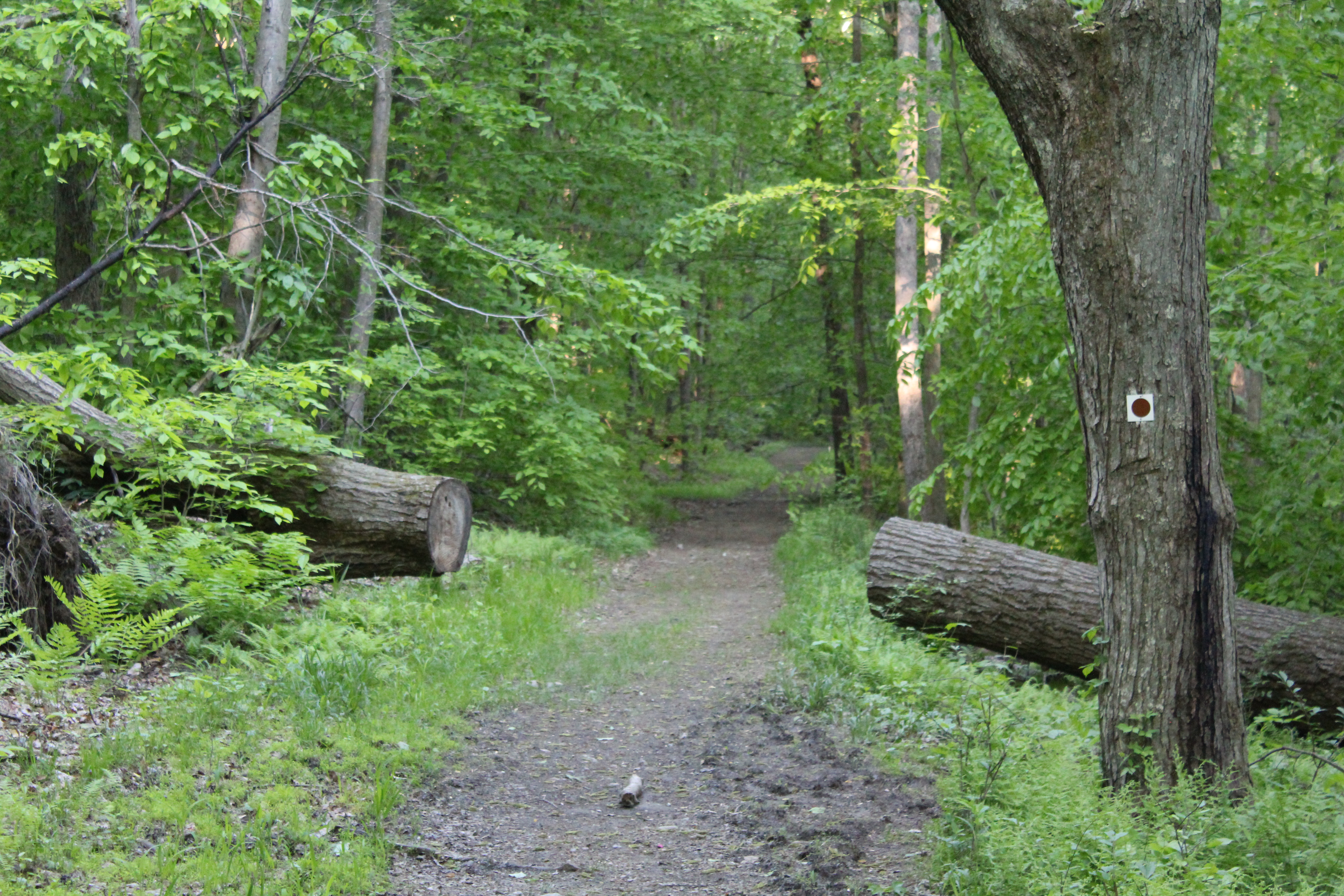
As you cross 9W and enter the woods, the trail immediately turns to the left and then you begin a relatively steep climb. Don’t worry, because after about ten minutes, the trail levels off and you are able to catch your breath as you continue to move steadily towards the most serious climb of the day.

Jaime on the Cornell Mine Trail-I’ve been hiking with this guy for over twenty years!!!

As you hike towards Bald Mt., you will notice that the terrain is pretty diverse in regards to what it has to offer. At one point you may be hiking on what appears to be a well manicured trail, and on others you will have to keep your eyes on the ground in front of you due to large amount of loose rocks laid out in front of you.
After a little more than a half an hour of hiking, you’ll notice the huge and imposing figure of Bald Mt. directly ahead of you. Even though it looks much more imposing during the winter months when the trees have no leaves, even now you certainly know that it is there, waiting for you. Trust me, it is going to suck the life out of you if you let it! As you approach this part of the climb, it appears relatively flat. Don’t be fooled by this because the most challenging part of the climb awaits you. The trail quickly begins a steep and unrelenting climb up to the view-point. To ease the pain, you will find some switchbacks on the first part of the climb that offer a modicum of relief. Remember that you will be climbing a vertical distance of 500 feet in less than half a mile.
A quick word of caution to all hikers regardless of experience-The footing on this, the most difficult part of the hike, is pretty treacherous. Please be very careful based on the fact that loose dirt and rocks combine to make for what could be a bone busting experience!
After you have climbed about 80% of the mountain, the trail will take a very sharp left. Before you head up and finish the Cornell Mine Trail, turn around for a stunning view of the Bear Mt. Bridge.


After soaking in the view and taking a well earned rest, turn back around continue to head the trail. In just a few minutes, The Cornell Mine Trail ends at a junction with the Ramapo-Dunderberg Trail. Make sure that you turn right onto the Ramapo-Dunderberg Trail and continue climbing. Although you are still moving up, it is nowhere near the intensity of the rest of the climb. After leaving the intersection, you should reach the summit of Bald Mt. (Elevation 1,080 feet), in about ten minutes. As you get closer, you will continue straight ahead on an unmarked path to reach the summit. At this point you will have climbed more than 1,000 vertical feet from the start of the hike on route 9W to the summit.
Even though there was some haze in the air, the views were magnificent and I believe that I was able to get some good pictures. To give you some perspective, Anthony’s Nose is the mound on the right side of the bridge.

Bear Mt Bridge with Anthony’s Nose to the right.

Bear Mt. Please note the tower about 3/4 from the right.

Perkins Memorial Tower as seen from Bald Mt.


After relaxing for a while, you can take the red on white trail markers on your right and start heading down. Once again, the trail down has some pretty loose dirt and rocks and with the first descent being quite steep, you might want to be more cautious than you normally would be. After a brief leveling off, you continue heading down the trail, eventually coming to an almost tunnel of Mt. Laurel.

When you reach the stream, you will make a quick right turn and shortly after that the Ramapo Dunderberg trail continues to the left. For our purposes, we decided that instead of heading to the Timp, we would continue down on a woods road into Doodletown. This woods road soon becomes the 1777 trail.

As you come down a final small hill, the trail levels off and crosses a stream. To the right, stone foundations and a trail shelter can be seen. You have to make sure that you look quickly because if you aren’t paying attention, you may miss the shelter!


As you continue ahead on the woods road, you will soon enter and move through the former settlement of Doodletown. This settlement thrived in this area for two centuries until it was acquired by the park in around 1960. But before you get to Doodletown, keep looking around to make sure that you don’t miss these views.


This sign below represents a walking tour sign to help guide you through the area.

At this point you will have been walking on paved roads and will continue to do so until the hike ends.

A stone wall from one of the many houses at Doodletown.

We kept hiking along the 1777 Trail, which is also known as Pleasant Valley Road, and as you make your way down the road, you will pass the remnants of the many homes that formed Doodletown. You will see markers like this all along the trail to show where each of the houses in the settlement were located.

One of the more interesting sights that you can see in the Doodletown settlement is the remnants of their garbage. Apparently they used to bury their garbage and from time to time, you can see garbage that has “floated” to the top through erosion of the land. A good example is this broken milk bottle:

As you near the end of this particular hike, you are treated to some nice views of a pond as well as some of the flora in the area.


The hike ended up being about 5 1/2 miles with just over 1,000 ft in elevation gain. With stopping to rest and taking pictures, it took us about 3 1/2 to complete. Based on its level of difficulty as well as numerous viewpoints and other worthy sights, this is definitely a hike you don’t want to rush through. Take your time to soak it all in, it’s worth it!
Now, with all of that said, although I would never discourage anyone from taking a hike, if you want to take animals small kids on this one, you need to be really careful.The steepness of the climb as well the loose dirt and rock on the climb could prove to be too much for a smaller child or a dog.
Any adults, however, who want to do this hike, I say GO FOR IT!!!!!


Wow, great photos and writing I feel like I was right there on the hike!
LikeLike
Thank you for the kind words!!! We are truly blessed in this area with some great hiking.
LikeLiked by 1 person
I do apologize for the late reply! Thanks very much for the kind words-I’m glad that you enjoyed the post.
LikeLike
I have never heard of Doodletown and I’ve lived in this area most of my life. I can’t wait to research it. Your pictures are gorgeous and I can see why the views make the hike worth it. This is waaaaay out of my league though. I see you are at a higher elevation than Anthony’s Nose. Bear Mt. too? I couldn’t tell from the picture ( I’ll re-read your post in case I missed that).
Is there a road into Doodletown? I can’t believe I’ve never heard of it. I’ve spent years going to West Point frequently.
LikeLike
This is one of the toughest hikes in the area. You can get to Doodletown from Route 9W. The only bad thing is getting there. It’s all uphill! Not killer uphill, but uphill none the less.
LikeLiked by 1 person
So you can’t drive there? The only way is to hike?
LikeLike
Better get those feet moving.
LikeLike