Tag Archives: Harriman Hikes

Ramapo-Dunderberg Day One

The start of the my short shakedown hike (6/27) was as humid as you would expect for the end of June in New York. Temperatures in the mid 80’s with humidity almost equally as high guaranteed an early soaking. Since my son had a job interview that morning, we had him drop us off at the Tuxedo RR station at 6:30 am.  Starting early would also put us ahead of the heat and the humidity. The station marks the start of the Ramapo-Dunderberg Trail.

IMG_6603_edited

The view after the first climb.

The plan for the day was a simple one. Hike just a little over six miles and then spend the night at the Bald Rocks Shelter. Even though it was only six miles, I hadn’t hiked with a full pack in awhile and coupled with difficult terrain and weather, it was a long day. According to our GPS, we gained just about 1500 feet of elevation! Obviously the views were great.

IMG_6612_edited

IMG_6613_edited

IMG_6616_edited

The Bald Rocks Shelter is an interesting one.  This blurb was taken from MyHarriman.com:

  • Bald Rocks (Ramapo-Dunderberg Trail).  Massive local granite stones make up his walls, with a nice fireplace inside and a firepit outside.  The surrounding area is grassy, with trees close enough to allow hammocking, but not too tight to make you feel like you’re in the woods.  Because you’re not — you’re in a lovely grassy field on top of a hill. Great views, too!  The trails you’ll use to get to Bald Rocks are some of the best in the park, too, and you’ll be camping near some of Harriman’s coolest sights: Bowling Rocks, Ship Rock and the spine of Hogencamp Mountain.  Nice.
IMG_6622_edited

The Bald Rocks Shelter

IMG_6633_edited

Inside the shelter

IMG_6642_edited

The fireplace inside the shelter.


Happy Hiking!!!

Hike #20-6.25-116.95

Which Way Photo Challenge-(CCW)

For this challenge I chose three photographs that I have taken while hiking. The first denotes where vehicle travel ends and foot travel begins on a trail in Harriman State Park. The second and third were taken in Bear Mt. State Park along the Appalachian Trail. 

Second Reservoir 2597_editedIMG_6852IMG_6851

Ascend (3)

Many of my favorite photos are ones that I take when I am hiking. This photo, is just another example of another steep climb during a hike in Harriman State Park in New York. It ascends several hundred feet in just under a half of a mile. Once again, here is a nice reminder of an early morning summer hike on a snowy day here in New York.

IMG_6791

Ascend

Lake Wanoksink (13)

‘Thousands of tired, nerve-shaken, over-civilized people are beginning to find out going to the mountains is going home; that wilderness is a necessity…”
― John Muir

Starting at the Lake Sebago boat launch, the blue blazed Seven Hills trails begins as soon as you cross Seven Lakes Drive. Like many of the hikes in this area, as soon as you enter the woods you begin a punishing climb. This one happens to go on for approximately half of a mile. The pictures below show the steepness going up and down the trail. On the left is the climb up. Since this is a loop hike, the picture on the right is the hike down.

The trail continues moving downhill until you begin another ascent where the Seven Hills Trail veers sharply off to the right  and for a brief time becomes Woodtown Road West. After about a quarter of a mile, you make a sharp left turn and begin walking on Pine Meadow Road West.

72517005

The point on the Seven Hills Trail where it becomes Woodtown Road West.

Although this sign is pretty big and prominently placed where it can’t be missed, people still drop water bottles, trash and yes, even diapers on the trail and the side of the trail.

72517006

You would think that this sign was self explanatory…

Stay on this road until you intersect with the end of the yellow blazed Buck Trail and then make a right turn onto Pine Meadow Road East. Although the Harriman-Bear Mountain Southern Trail Map 118 is pretty detailed about where you need to go, these roads are unmarked and some trails and other roads veer off to the left and right all along your route. At one point I did make a wrong turn but with good results. I stumbled upon these ruins and I took a short break to rest and take some pictures.

72517008

72517010

After doubling back to the correct trail, I eventually got to the shores of Lake Wanoksink where because of  the weather, the views weren’t that great. It’s still an interesting picture!

72517016

Lake Wanoksink

Once you head around the lake, take some time to walk across the earthen dam where if you look to your left, you see this bridge that you will soon cross over.

72517017

Happy hiking!!!!!

Summer 2017 Mileage:

7/25/17-7.1-65.72

Silvermine (6)

“Let me live where I will, on this side is the city, on that the wilderness, and ever I am leaving the city more and more, and withdrawing into the wilderness.” 

-Henry David Thoreau

“Once in awhile, climb a mountain or spend a week in the woods. Wash you spirit clean.”

-John Muir

“Life is better in hiking boots.”

-Every hiker

Located about 2 miles on Seven Lakes Drive, Silvermine Lake is currently a fishing, picnicking and hiking area in Harriman State Park. Back in the late 70’s and early 80’s, it used to be a pretty popular area for families to go for the day to just hang out and have a good time. As a child I have fond memories of going to this lake and running through the woods, skipping rocks on the water and eating many hot dogs!

IMG_6796

A sign on the Menomine Trail next to Silvermine Lake.

IMG_6798

After leaving your car, head towards the lake and you will see a yellow blaze on a rock. This is the Menomine Trail, the one that you will follow until you reach the William Brien Shelter where you will then begin hiking on the dually blazed Appalachian/Ramapo Dunderberg Trail.

IMG_6802

Silvermine Lake at the beginning of the hike.

As you enter the woods and wind around the lake, the trail has its fair share of ups and downs on some very rocky terrain.

IMG_6804

The trail before a steady steep climb.

As the trail veers off to the left, you begin a steady and then very steep climb until you reach the shelter.

IMG_6806

The start of what turned out to be a killer climb!

IMG_6807

The second section of the climb. I thought once I reached the top where it curves left, the climb would be over. 

IMG_6808

I was wrong. It only got worse…This is the last section of the climb.

Once you get to the top, the William Brien Memorial Shelter is on your left.

IMG_6809

The William Brien Memorial Shelter

As I mentioned earlier, once you get to the shelter you would leave the Menomine Trail and continue hiking on the Appalachian/Ramapo Dunderberg Trail. Turning left, you immediately begin another steep climb, this time pretty short.

IMG_6810

Appalachian/Ramapo Dunderberg Trail

You will follow the AT until you reach a woods road. Turning left, you begin a steady descent until you reach the lake.

After returning to Silvermine Lake, I had some extra time so I decided to follow the Menomine Trail in the opposite direction.

IMG_6813

A strange looking tree…

IMG_6812

The trail covered in pine needles.

HAPPY HIKING!!!!!

Summer 2017 Mileage:

7/6/17-5.5-25.32

Iron Mines Short Loop (4)

“Hiking is the answer. Who cares what the question is.

-Anonymous

“I walk, I look, I see, I stop, I photograph.”

-Leon Levinstein

After resting my ankle for three days, I decided it was time to get back out into the woods. The swelling was gone and it felt pretty good so I figured at the very least I would lace the boots up and if it hurt too much I could just turn around and end today’s hike early.

As you pull into the parking lot, this is your view.

IMG_6763

Lake Skannatati

As is the norm with most of my summer hikes, I got the parking area pretty early today. Since it is the day before Independence Day, I thought that even at this hour more people would have been out. But at 6:10 am, the only other person I saw was this guy fishing!

IMG_6768

To the right of the lake you immediately see a kiosk and two trails. This will be the start as well as the end of the hike. The blue blazed Long Path is on your left and the red triangle A-SB (Arden Surebridge) will be on your right.

IMG_6770

The beginning and end of the hike.

Starting on the Long Path, you will wind your way around the lake, mainly staying on even ground. As you move deeper into the woods, you begin a series of small ups and downs on the trail until you intersect with the yellow blazed Dunning Trail. If you are looking for an even shorter hike than this one, you could make the right onto this trail and it will eventually intersect with the A-SB trail. Instead, take a left and after a few minutes the Long Path will turn off to the right while Dunning Trail stays on the left.

IMG_6777

The Long Path intersects with the Dunning Trail

Staying on the LP, you begin a steady climb until you reach the A-SB trail.

IMG_6775

The blue blazed Long Path

IMG_6778

IMG_6779

Red Triangle A-SB Trail

IMG_6781

Heading down the A-SB Trail back towards the lake.

Once you turn onto the A-SB trail, it’s mainly all downhill until you get to the lake.

Overall I enjoyed this hike. The difficulty rating of moderate that I have seen in its description seems appropriate. The only negative thing that I can see with it, and this has been an issue with the Long Path in the past is the way that they blaze the trail. While I was on the LP today I spent way to much today not being able to find blazes and I had to reroute myself several times.  They could definitely put some of the blazes closer together and at critical junctures make it easier to follow them.

Summer 2017 Mileage:

7/3/17-4.3-16.02


The Horn Hill Bike Path

“With beauty before me, may I walk 
With beauty behind me, may I walk 
With beauty above me, may I walk
With beauty below me, may I walk
With beauty all around me, may I walk
Wandering on the trail of beauty, may I walk”
–  Navajo: Walking Meditation 

“And into the forest I go, to lose my mind and find my soul.”

-Unknown


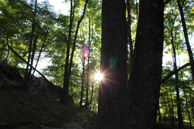
It was yet another beautiful day here in the Hudson Valley (7/11/16). When I got to the south parking lot of the Anthony Wayne Recreation Area (AWRA) at about 7:15 am, the temperature was in the high 60’s  with no real humidity. Their was a slight breeze, which at that time of the morning actually raised goose bumps on my arms. Without a doubt, that certainly beat the alternative of heat and bugs. For almost the middle of July, you couldn’t ask for anything better!

The other day I introduced you to a book  written by Don Weise called, Circuit Hikes in Harriman-35 Loop Hikes and Trail Runs in Harriman and Bear Mountain State Parks. Since I am familiar with the AWRA, I  saw the Horn Hill Bike Path listed as one of the “trail runs, walks, ski loops, and mountain bike rides” and decided to try it out.

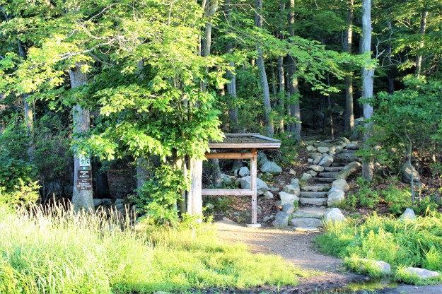
After you get off of the Palisades Parkway and enter the AWRA, go to the second parking lot (the south lot) and park by the kiosk. This marks the start of your hike as well as the end.

IMG_8732

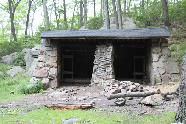
Depending on the time of day that you begin (or end) your hike, this would be the perfect place to sit down and enjoy a snack. It is well shaded and today it even had a bed of pine needles that you could easily throw a blanket down on if you chose to do so.

IMG_8810

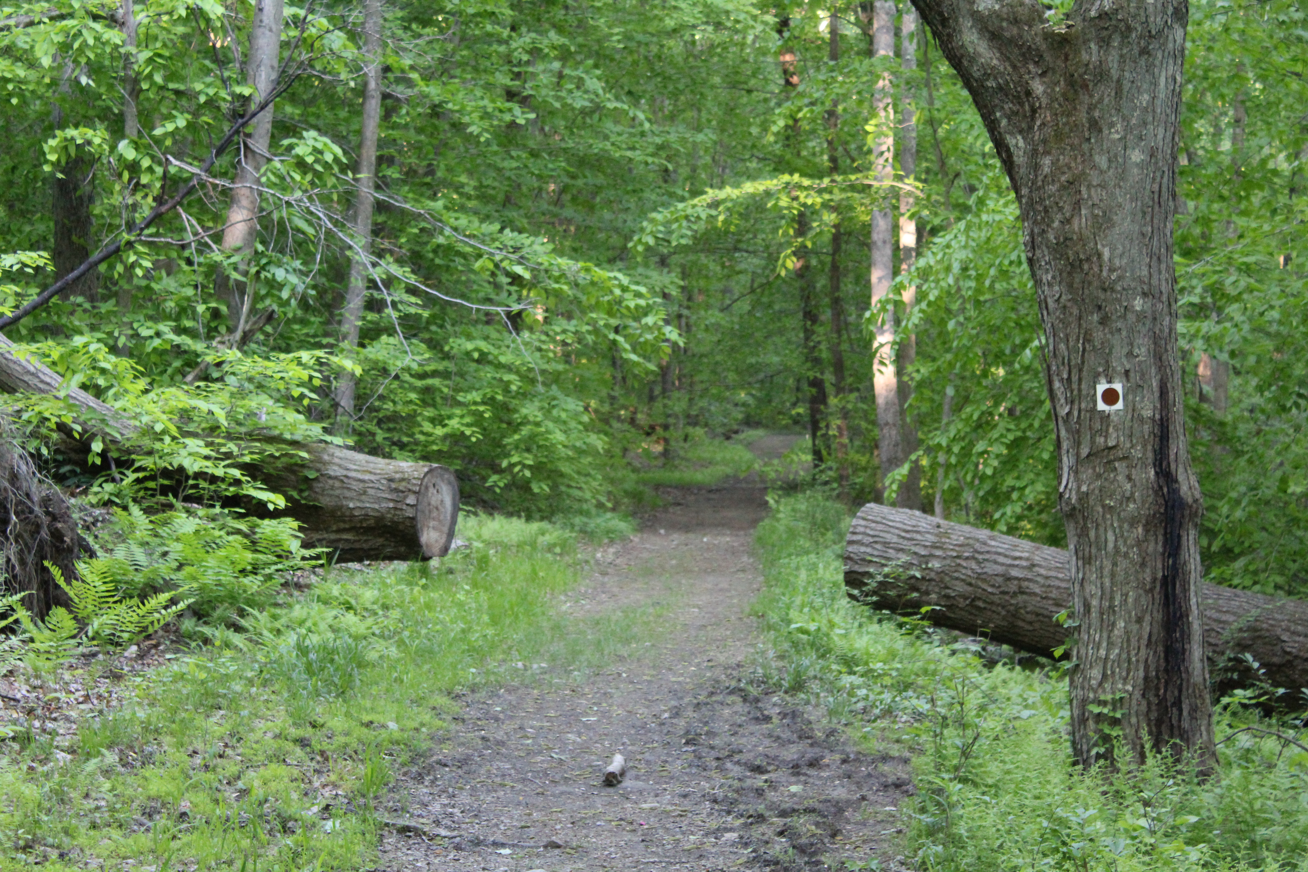
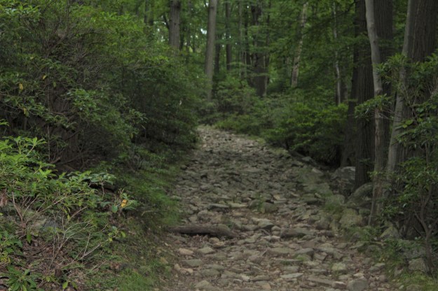
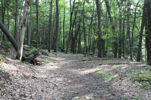
Starting out on the bike path, the walking is easy as the trail is flat and winds through the woods with a serpentine like quality. Tree roots fill the trail and almost beg you to be cautious as you move south away from the parking lot and further into the woods.

IMG_8737

IMG_8738

IMG_8739

The trail continues winding through the woods and still has not gained any appreciable elevation. As I kept walking, I couldn’t help but think about how much small(er) children would enjoy this hike. Since the area is wide open, they can actually run ahead of you (a little bit!) and do some exploring. The one thing that they will really love are the wooden bridges that guide you for the first part of the hike.

IMG_8747

IMG_8749

IMG_8750

After approximately ten minutes of hiking, the bike trail intersects with the AT for the first time. Even at 7:45 am, I could hear thru hikers in conversation as they were already making their way towards Bear Mountain.

IMG_8751

Crossing the AT, the trail meanders until it makes a 90 degree left turn. Weise’s book has a short loop and a long loop listed as your choices for the day. Either one would be a worthy choice, but if you choose the short loop (3.85 miles), you will continue on the Beechy Bottom Road for the remainder of the hike. If you decide to hike the longer figure eight loop (5.6 miles), the trail veers off to the right, .1 of a mile after you make the left turn. After the turn, the trail is no longer flat and you start climbing up hill pretty steadily.

IMG_8760

Although this is a climb, it certainly is manageable and shouldn’t cause much distress. After several minutes of heading up hill, the trail flattens out and you are directed to make a right turn to continue the climb.

IMG_8761

IMG_8762

IMG_8763

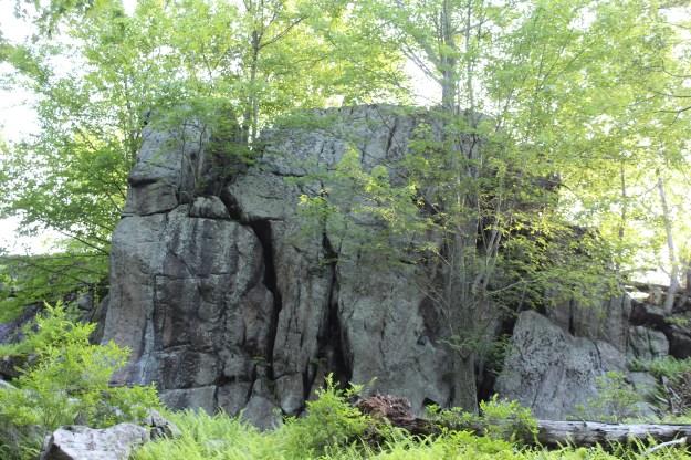
As you move along, make sure that you take the time to check out everything around you. I was pleasantly surprised at the diversity of the trees, plants and bushes in the middle of July and I can only imagine what this area looks like when the fall foliage is in full effect later in the year.

IMG_8764IMG_8766

The loop will continue on a downwards slope and as you near the end and just before you rejoin the Beechy Bottom Road, you will literally be yards from the Palisades Interstate Parkway. I had originally planned to take a water break at this point, but I quickly changed my mind. After enjoying so much quiet, I found that the vehicle noise from the Parkway disturbing to say the least. Wanting to get away from the cars, buses and horns as quickly as I could, I forged ahead and didn’t stop until the quiet returned. Luckily, at this time of year, the woods are pretty dense and this has a habit of dulling all of the extraneous noise that civilization produces, which meant a return to peace was not far off.

Soon after my water break I finished the loop and headed on to the Beechy Bottom Road. Since I could only hear the clicking of my hiking poles and the sound of my boots propelling me forward, I knew that the peace I longed for on the trail was with me again.

IMG_8767

IMG_8772

IMG_8773

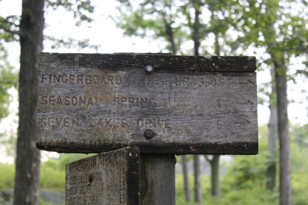
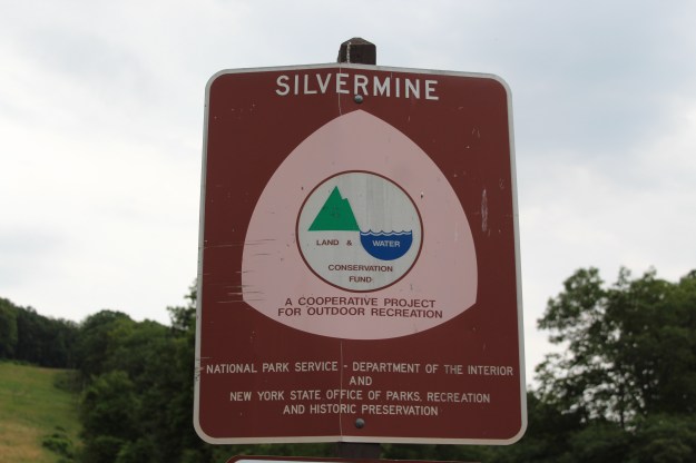
Once again, the AT runs through the bike trail and heads steeply up West Mountain (Not noted on the sign below).

IMG_8776

Moving on, the road remains flat and there are many places to stop and eat lunch, a snack or just to rest. If you choose not to stop for an extended amount of time, you will find that the miles disappear quickly. Although the hike never really gets difficult, the fact that you have been walking on roots and rocks for most of the way make for some sore feet. At this point you are beginning to feel it!!!

IMG_8778

IMG_8779

IMG_8780

As you near the end of the hike, you will go down a short downhill section and you will see a sign that tells you to go right. After you make this right turn, immediately veer left instead of staying on the road. I make this point because even though I read the description in Don Weise’s book, I continued on the road itself. This, of course, is no fault of the author, it was my not reading it correctly! Anyway, that added about 1/2 mile onto the hike as I figured out my mistake when the road ended and I had nowhere else to go.

Turning back around and heading back on the road, I made the correct turn and about 15 minutes later, you will see this locked gate, signifying the end of your hike in the woods.

IMG_8784

At this point you will turn left and walk all the way to the far parking lot where you began. Since I did the longer loop and added about a half of a mile due to my mistake, this hike ended up being just a little over six miles.

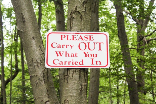
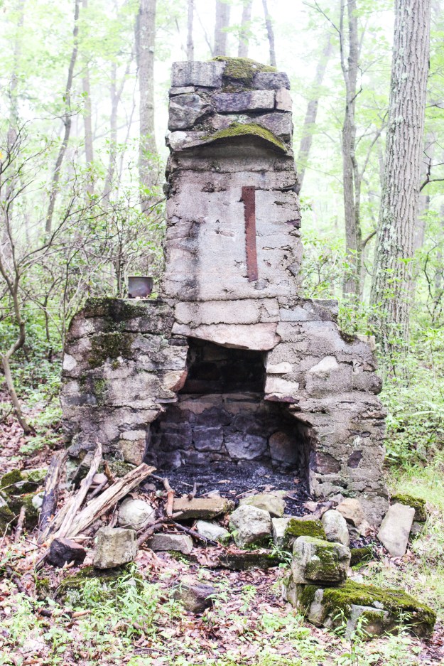
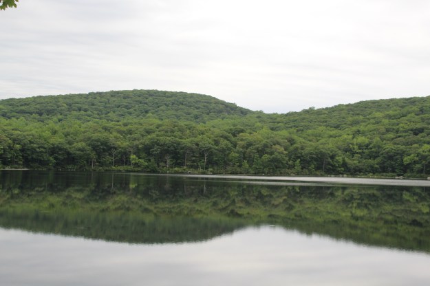
Although I was tired, the walk back on the road next to the main parking lot had several interesting things to photograph. Here is a sample of what I saw on my walk back to my car:

As with every hike that I do, I can tell you that this was a truly an excellent way to start the day! It helps to keep things in perspective and allows for time to reflect without all of the distractions that we are faced with each and every day.

Thank again to Don Weise as this proved to be another superb circuit hike that I not only look forward to doing again this summer, but also as the seasons change.

Another Great Hike-Stockbridge Mountain and Lake Nawahunta

IMG_8644

Before I even begin to fill you in about the awesome hike that I did today (7/7/16), I really need to address this sign. I encountered this “ICE” sign about 1/2 of a mile down the road from the Silver Mine Picnic Area. Even though it was only a short distance into my hike, by the time I looked up and saw the sign in front of me, I was already bathed in sweat and as I always do when it is this hot and humid, I wonder, often times out loud, “WTF am I doing??” But I couldn’t help but laugh out loud as I thought about the absurdity of having an ICE sign be the first thing that you would see on today’s post. When I began hiking at 7:20 am, the temperature was already in the mid  70’s with humidity near 90%.

Ok. With that out of the way, I was on Amazon a few days ago and I saw and eventually bought a book called “Circuit Hikes in Harriman-35 Loop Hikes and Trail Runs in Harriman and Bear Mountain State Parks” by Don Weise. Even though I have the trail maps associated with both Northern and Southern Harriman and Bear Mountain, it is sometimes difficult to figure out distances, elevations and other pertinent information  you might want to know when you are planning a hike. So if you hike by yourself or don’t want to do a two car hike, this is the book for you!

As I flipped through the book, I immediately liked the way that the author has each hike laid out. Each one is a chapter of the book and has all of the  information that would need to plan a hike. With each hike you get a rating, distance, hiking time, attractions, lowest elevation, highest elevation, total elevation gain, parking GPS coordinates and what map is associated with the hike.

After the 4th of July lung buster , I thought that for today’s hike I would look for something in the easy to moderate range (the author’s method of describing each hike).  I settled on the Stockbridge Mountain and Lake Nawahunta Hike (Weise 87-91). With a distance of 5.2 miles, a total elevation gain of 990 feet and a difficulty rating of easy to moderate, this would be the perfect way to start the day (87).

Parking at the Silver Mine Picnic Area, I found the Menomine Trail (yellow Blaze) and headed out on the trail.

IMG_8635

IMG_8646


Even at the picnic area, you should take some time to just look around and take in the view.

IMG_8633

IMG_8630

IMG_8639

Running parallel to Seven Lakes Drive, the trail quickly crosses the road and becomes an idyllic earthen trail covered in pine needles. You wouldn’t think that in July  you would be overcome by the smell of the pine needles, but this was certainly the case today. It was truly intoxicating!

IMG_8647

IMG_8651

As you move steadily along the trail, look to your left and you will see Lake Nawahunta.

IMG_8650

IMG_8691

I can’t explain the feeling of the soft earth under your feet as you move through the woods. The sounds of birds filled the air as well as the chipmunks searching for food, often times surprised by the sound of my boots hitting the ground forced them to scramble for cover.

Shortly after you pass the lake, you will see the Menomine Trail veer off to the left and an unmarked woods road heading up and to the right (you will return and finish the hike this way). You are going to take the unmarked woods road. Don’t worry, even though it is not marked, you can’t possibly get lost or wander off of the trail.

IMG_8652

The hiking is pretty easy as you proceed along the trail. Very slight ups and downs provide you with a sense that you are gaining elevation, but not so steeply that you can’t enjoy everything that is going on around you on the trail.

IMG_8653

IMG_8654

IMG_8655

IMG_8656

IMG_8658

Just about 1.8 miles into the hike, the unmarked woods road intersects with the Long Path. If you are hiking with small children or are looking for a relatively easy 4 mile hike, turn around here and head back the way that you came. If you are going to continue on for the next 3 miles, turn left and follow these aqua blue blazes:

IMG_8659

One thing that you will notice as you make the left turn on to the Long Path is the ground becomes much more rocky than the previous 2 miles.

IMG_8661

IMG_8662

IMG_8663

IMG_8664

Even though the climb itself is not that steep, from the time that you turn onto the Long Path, you find yourself heading uphill. With the humidity as high as it was, I took the opportunity to stop several times to drink water so I wouldn’t get dehydrated.

IMG_8668

Looking back down the trail as I take a water break.

IMG_8669

Still some more climbing ahead!


IMG_8672

The climb comes to an end and three miles into the hike you will come across one of the most interesting sights in the entire park. The Stockbridge Cave Shelter (see photos below) has a fireplace and plenty of space for several people to sleep. Upon inspection, it is obvious that it is well used, but with that said, there was no litter and that was actually nice to see for a change.

IMG_8673

IMG_8674

IMG_8677

Check out the chair made out of a tree. It was a lot more comfortable than I thought it would have been!!!

After hanging out at the shelter for a bit, I took the trail up to the right of the shelter. Seeing the initial steepness of this climb, I originally thought that I was in for more of the same of what I had just experienced.

IMG_8678

This was not to be the case and as I crested the top I was happy to see the terrain level off as I continued towards my destination.

IMG_8679

After passing the Stockbridge Shelter, the trail heads steeply downhill and intersects with the Menomine Trail. This is the yellow trail you started on and it will take you all of the way back to your car in the Silver Mine Picnic Area.

IMG_8683

IMG_8684

The end of the Menomine Trail. Follow this trail all of the way back to where you began your hike!


IMG_8686

As I approached the lake, the overwhelming smell of pine took over took my senses once again and as I stopped to take a picture, I stood and took several deep breaths. Closing my eyes, all I could imagine was setting up a tent and hanging out for a couple of days!! Unfortunately, this spot, as incredible as I think it is, was just to close to civilization for my liking.

IMG_8687

IMG_8688

IMG_8690

Shortly after passing the spot in the picture above, I was back on Seven Lakes Drive heading back to my car. As I slowly walked on the side of the road, now totally dripping wet from sweat, I thought about Don Weise’s book and found the information in it to be spot on. If I still had younger kids I would definitely take them on this hike and remember, you can make this shorter if you need to for whatever reason.

A big thumbs up for the Stockbridge Mountain and Lake Nawahunta hike!!!!!!