Tag Archives: Hiking the Appalachian Trail

Camera Or No Camera?

app trail blog image_edited

Thru hiking the AT has been a bucket list item for me since before I even began thinking about a bucket list. In an effort to be as prepared as I possibly can for a thru hike, I want to use this blog as a way to ask questions and get opinions/advice on whether my thought process is sound. More importantly, it will allow me to continue blogging about what I love to do.

Even though I have read many, many books and articles and watched hundreds of videos about the AT, I feel almost a sense of urgency now to continue to not only keep doing the same, but to also further refine my reading to researching about how to thru hike the AT. I know that sounds odd, but there is so much information out there about every aspect of hiking, that I want time to be able to sift through it all make informed decisions. Or….I might like something from start and go with it!!

One of my first questions/concerns has to do with pack weight. I understand lighter is better, but since this could be a once in a life time adventure,  should I bring my DSLR camera with me? Is the 2-3 pounds of extra weight and the lost space worth it? I am saying yes for a couple of reasons. The first is pretty simple. I know this camera. I know the limitations and what can be done with it and at this point it is pretty much an extension of me whenever I am out hiking.

The second is much simpler. I want to be able to document this endeavor in the best possible way for my family and whoever might want to look at the pictures and follow the blog.

So what do you think? Go with what I like and know or am I missing something??

Any sane ideas will be considered. Insane ones receive priority consideration.

Why The AT? Then Again, Why Not?

Image result for appalachian trail sign

“To travel, to experience and learn: that is to live.” –Tenzing Norgay

In a little under two years I will be eligible to retire from my job as a special educator. In NYS, teachers can retire at the age of 55 if they have 30 years in the system. Directly after high school I spent four years in the Marine Corps, then went to school and worked other jobs for  several years before teaching.

So what does this mean? It means that my time in education is near an end. So what next?

As I mentioned in my previous post, my first goal in retirement is to thru hike the Appalachian Trail. As a matter of course, the first question that everyone always asks anyone with a similar goal is “Why?”

With that said, let’s get the “why” out of the way.

My first adult real life challenge came in October 1983 when I reported to Parris Island, SC for basic training with the USMC. Without a doubt, this was the most difficult thing that I had done in my life, both physically and mentally. To describe it as three months of pure hell would be an understatement!

After being discharged I began hiking more than I ever had and used this as my primary form of exercise during the months that were suitable for hitting the trail. The rest of the year was spent riding a stationary bike in an attempt to try to get and stay in shape. This remains true to this day.

So, when you look at my love of hiking and put that together with a lifelong desire to accomplish difficult tasks, a thru hike almost seems inevitable. Why not?

More on this as I continue my research of the AT and engage in some more self reflection.

Bear Mountain (Almost at Sunrise)

“Nothing is more beautiful than the loveliness of the woods before sunrise.”

-George Washington Carver

Every summer I feel the need to torture myself by doing two pretty difficult hikes at least once. The first one is Mt. Beacon and the second is Bear Mt. Today I decided to get Bear Mt. out of the way since the forecast for tomorrow is for the mid 80’s with high humidity. Starting off on the Appalachian Trail by Hessian Lake, the trail begins a grueling ascent immediately. The elevation at this point is 175 feet, but in less than two miles you climb 1,130 feet where you will be at Perkins Memorial Tower that has an elevation of 1305 feet.

Since they rerouted the AT over the last few years and have made significant improvements, although steep, the trail is a pleasure to hike on.

IMG_6937

It climbs…

IMG_6936

And climbs…

IMG_6934

And climbs some more…

IMG_6931

It seems like it never ends!

The AT does eventually turn off onto Perkins Memorial Drive. Instead of heading back into the woods, I stayed on the road so I could take some pictures. Part of the reason I was up here in the first place was to catch the sun coming up behind Anthony’s Nose. Unfortunately I missed it by about fifteen minutes!

IMG_6900

Iona Island is at the bottom of the picture. The city of Peekskill, NY is in the distance.

IMG_6902

The Bear Mt. Bridge and Anthony’s Nose just after sunrise.

IMG_6903

Looking north on the Hudson River

IMG_6897

Perkins Memorial Drive

Once you get to the top where the tower is located, you will get some amazing views. This one in particular because usually this time of year the haze blocks the NYC skyline.

IMG_6928 (2)

The NYC Skyline

IMG_6921

Due to the fact that improvements on the AT have moved closer to Perkins Memorial Tower, they have had to reroute part of the trail until it is completed.

IMG_6943

Hessian Lake at the base of Bear Mountain

Summer 2017 Mileage:

7/10/17-5.4-34.22

Fahnestock in Spring

“I find that the three truly great times for thinking thoughts are when I am standing in the shower, sitting on the john, or walking. And the greatest of these, by far, is walking.”

-Colin Fletcher

I believe that I have noted before that one of the best things about hiking in the Hudson Valley is how the terrain changes along with the change of each season. Today is April 30th and as you can see by the pictures, winter is out of the picture and spring is here to stay.

Today’s journey was a familiar one in Fahnestock State Park. Although it is a pretty short hike at 2.7 miles, it was nice to get out since I didn’t have the entire day to spend on the trail. Once again I was lucky enough to have my daughter join me (even though she said she had homework to finish!) and that always makes any hike that much better.

IMG_6429

The start and end to todays hike. You have to love the AT!

IMG_6396

“Although the vast majority of walkers never even think of using a walking staff, I unhesitatingly include it among the foundations of the house that travels on my back.” -Colin Fletcher

IMG_6389

Runoff from Canopus Lake in Fahnestock State Park. 

IMG_6391

The view on the 3 Lakes Trail.

IMG_6394

If you look closely at the water you can see the rain. It lasted for 10 minutes.

IMG_6395

IMG_6402

3 Lakes Trail

IMG_6403

In a couple of weeks this short part of the trail will be transformed into a lush tunnel of green.

IMG_6409

IMG_6411

I have hiked by this section on the 3 Lakes Trail and have never seen any evidence of beavers until today.

IMG_6414

More work by the beavers.

IMG_6416

The beaver dam.

IMG_6420

A cairn where the 3 Lakes Trail intersects with the Appalachian Trail. It seems to change every time I pass by it. 

IMG_6423

The view on the Appalachian Trail.

IMG_6425

Another view on the AT.

“Hiking and happiness go hand in hand (or foot in boot).”

-Diane Spicer

Zen On The Trail

I look up the trail and what do I see,

A day full of promise I think you’ll agree.

I hope and I pray for clear lucid thought,

The sun and the stars are all that is sought.

As I walk down the path and my mind starts to wander,

I take a deep breath, my heart growing fonder.

Is it possible? Can it be true?

Should I walk this alone, did I think it all through?

A path of enlightenment, Zen promises abound,

The earth and rocks flutter, a vibe from the ground.

So each step that I take, dust scattering the trail,

No way will I stop, no way will I fail.

I can now see the end, a magnificent view,

My love of the trail, a love that is true.


Hiking The A.T.

IMG_9178

I seek fellowship

On the white blazes of life.

Quiet steps blurred

By the shadows of hikers

Marching on the open path,

Seeking answers to

Everything, finding inner

Peace on the worn earth, 

Each step a reminder of

A fomer life left behind

Don’t have all day to hike and still want to get out? Here’s a hike for you.

If you only have a couple of hours and want to get a good sweat going, I have a pretty decent 2.5 mile hike for you. Located in the Hudson Valley, (Carmel, NY to be exact) Fahnestock State Park has over 500 miles of quality hiking trails that are well worth visiting. The best thing that I have found about Fahnestock is that as compared to other hiking areas in the Hudson Valley, most of the hikes here do not begin with a thigh hammering and lung busting climb. Sure, eventually you will have hills to climb, but I have found that for the most part, Fahnestock’s trails are meandering and actually quite pleasurable.

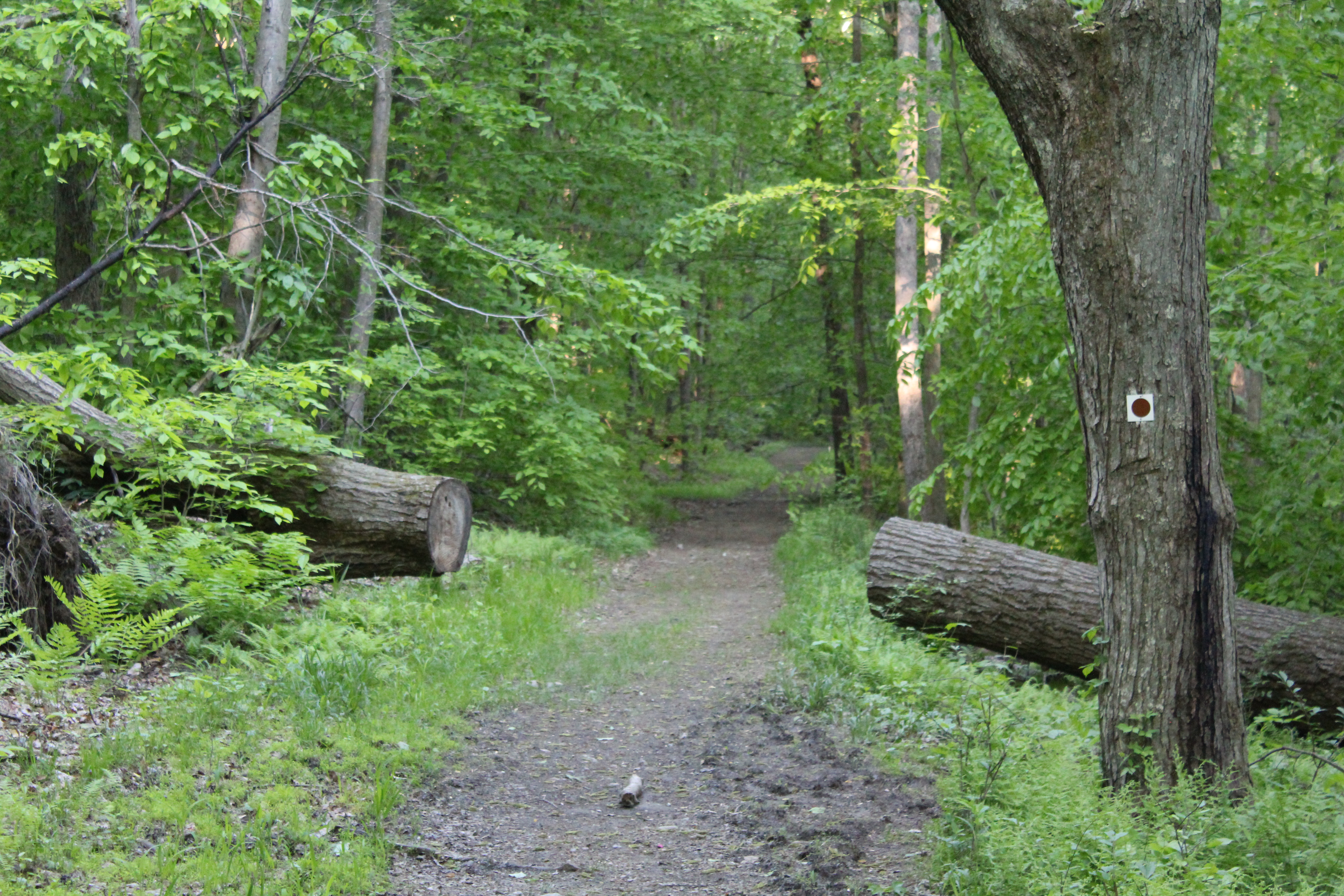
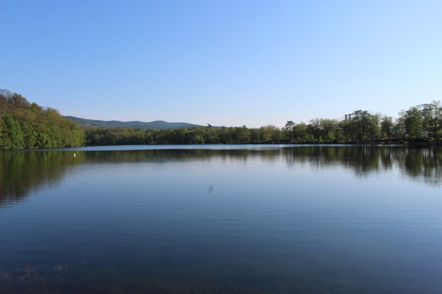
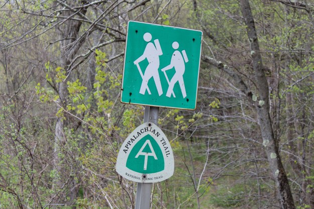
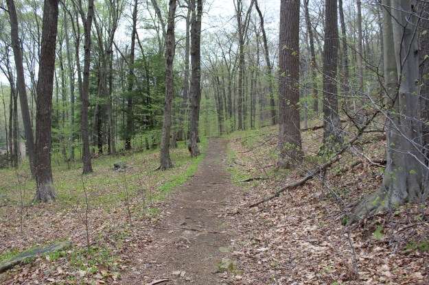
This particular hike begins on the Appalachian Trail (heading South) next to Canopus Lake on route 301.

IMG_8153

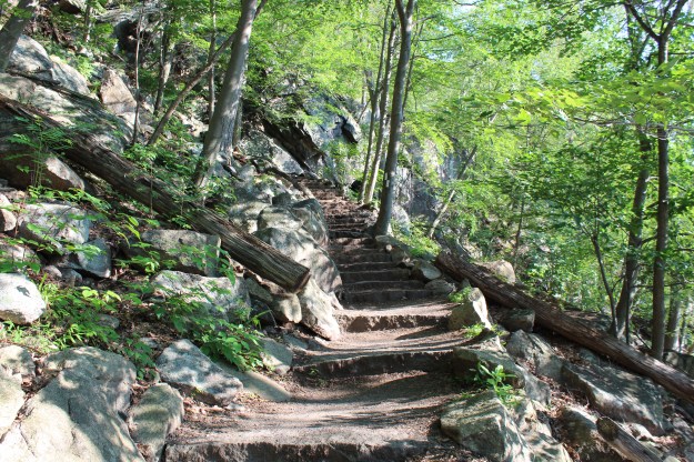
Although you start on the road on the AT, after descending some stone steps, the AT will continue to the right. You, however, will continue hiking until you reach the blue trail  (Three Lakes Trail). Don’t worry, it’s not that far.

IMG_8116 IMG_8113As you work your way down the trail, you will notice a mine entrance on your right off into the woods. Even though they are incredibly interesting, my advice to you is to not leave the trail to investigate them. Several people have done so and lost their lives. If you didn’t know, Fahnestock State Park is known for its rich iron ore mining that ocurred from the mid 18th century to the early 20th century.

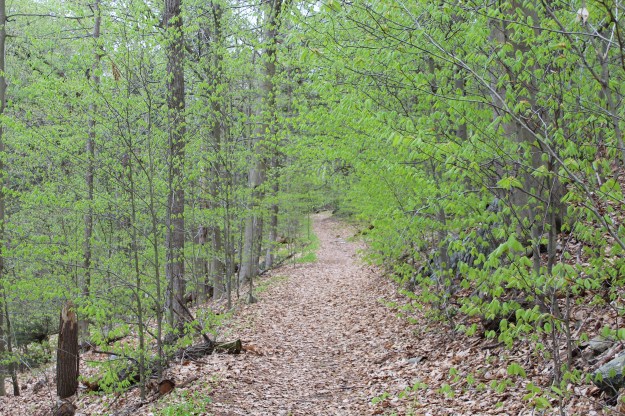
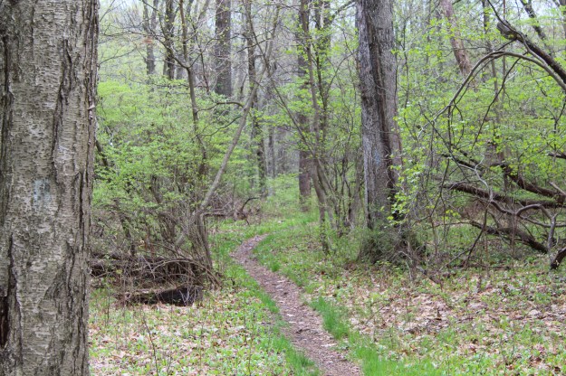
About a half mile into the hike, the terrain levels off and as the path winds through the woods, you will notice the changing vegetation and a drastic increase in the number of mosquitoes. Obviously from late spring and into the fall, bug spray is a must, especially if you are hiking with small children. Don’t think that just because it is a short hike you won’t suffer from bug bites. Take it from me, you WILL be eaten alive!

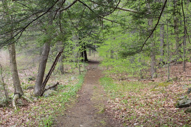
As you make your way up the trail, three quarters of a mile in you will come to a point where you can continue straight or turn right and stay on the blue trail. For this hike we are going to continue on the blue trail.

IMG_8121

The trail remains flat for a short time and then quickly descends to a small stream. The amount of water in the stream varies based on the time of year as well as how much rain has fallen in the recent past. On this day, not much water was running so crossing was a breeze!

IMG_8124

IMG_8126
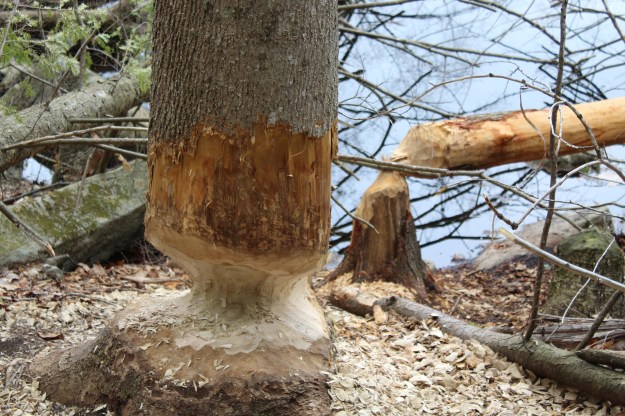
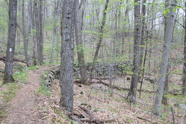
After you cross the stream, continue on the trail and hike up a small hill where you will see this on your right-

IMG_8136
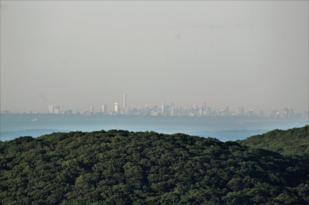
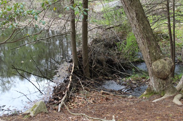
Even though the entire hike is only 2.5 miles long, this would be a perfect place to stop for water or eat lunch or a snack with the kids. After a break you will head downhill for a very short time and then you will begin climbing again. On this hike, this will be your only somewhat major climb. Walking steadily uphill for 5-10 minutes you will come across a large mound of rocks.

You need to pay careful attention at this point to the trail. As you look at the picture below, you can see a trail straight ahead and to the right. You will want to go right and you will now be on the AT (North). The Three Lakes Trail continues straight ahead for a few more miles. (that’s a hike for another day!) What you can not see in this picture is that the AT is also on the left, and that goes South.

IMG_8139

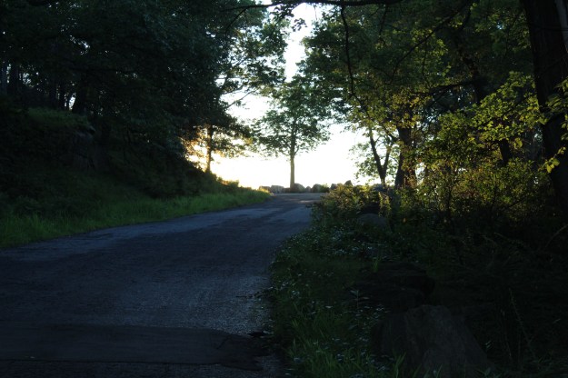
As you make the right turn onto the AT, it’s pretty much smooth sailing all the way back to where you began your hike on Route 301.

IMG_8144

IMG_8146

IMG_8149

This is the last landmark that you will see on the AT as you head up to the left back to the road. Like I said at the beginning of this post, this is the perfect hike if you only have a couple of hours to get out. I used to do this hike with my kids when they were younger and it proved to be the right length and difficulty to keep them interested in the hike.


.