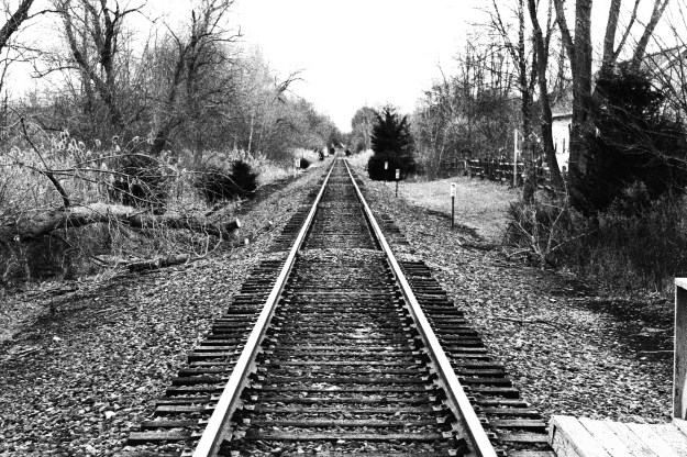
This is my favorite photo of 2017. I decided that after I dropped my daughter off at hockey practice that I would go to the Appalachian Railroad station to take some pictures. I actually sat down on the tracks facing north and took this shot.
This is my favorite photo of 2017. I decided that after I dropped my daughter off at hockey practice that I would go to the Appalachian Railroad station to take some pictures. I actually sat down on the tracks facing north and took this shot.
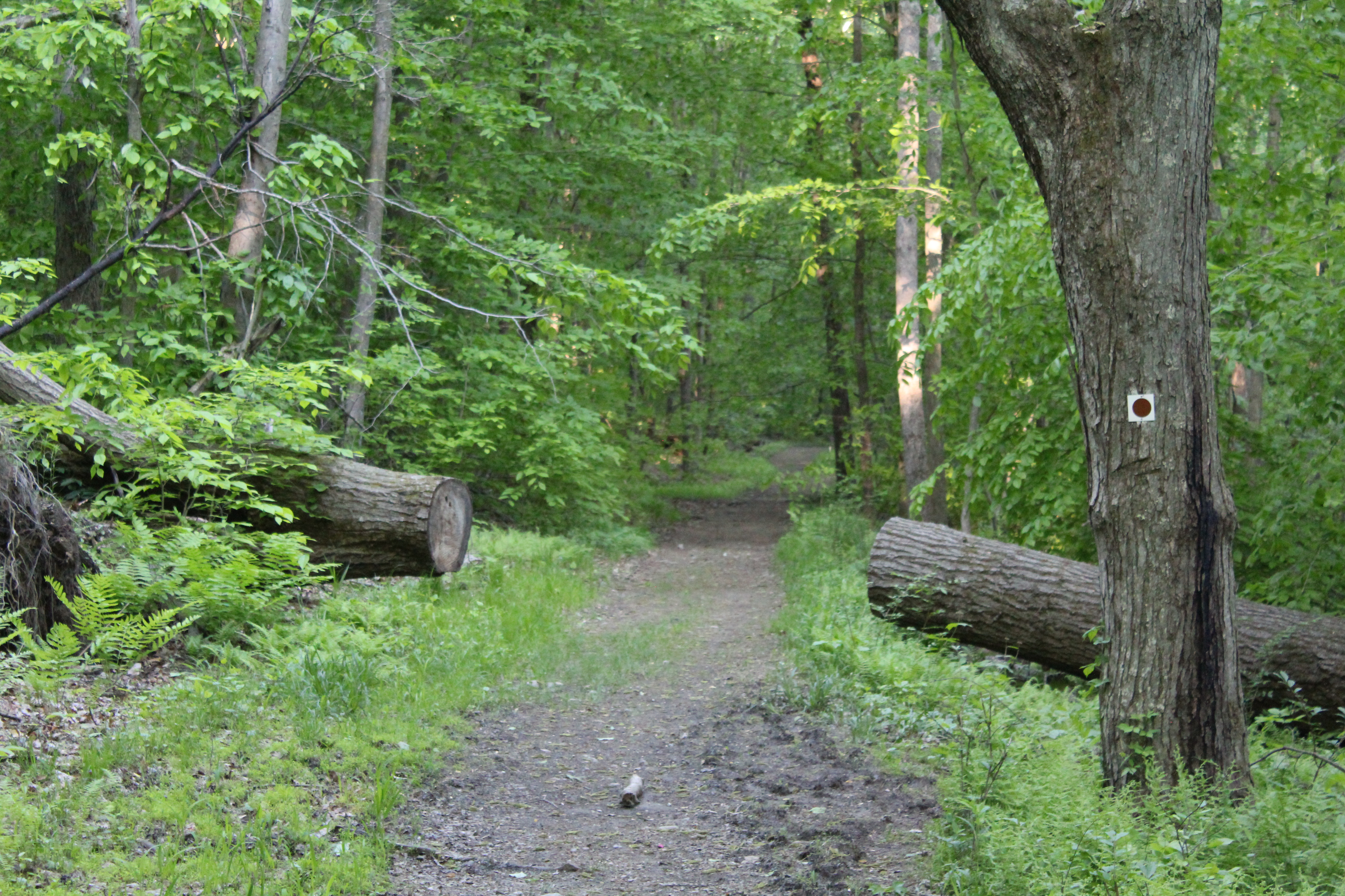
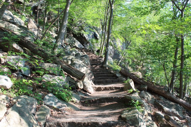
This is a photo of the Appalachian Trail in Bear Mt., which is located just off of the Hudson River in New York. Since we are getting some snow today where I am in New York, I though a reminder of what we have ahead of us would be nice!
The Appalachian Trail runs just about 2,200 from Georgia to Maine. A little known fact about the trail is that although you may encounter many freight lines along your journey, there is only one commuter rail station that is directly located on the AT. Stopping only on weekends and holidays, the MTA transports hikers and campers to the Appalachian Trail Station throughout the year.
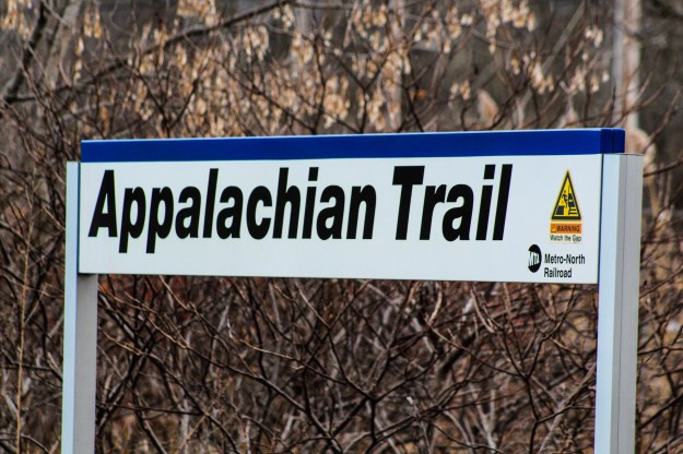
Located just off of Route 22 in Pawling, NY, the station was the idea of George Zoebelein, who did a great deal of hiking in the area and was a veteran of the NY/NJ Trail Conference as well as both the NY/NJ Appalachian Trail Conferences, and also served as a member of the Metro-North Railroad Commuter Council of the Permanent Citizens Advisory Committee to the MTA. The station, as you can see in the picture below, was built in three months by Metro-North Railroad in 1991 for the cost of pretty nominal cost of $10,000.

The Appalachian Trail Railroad Station.
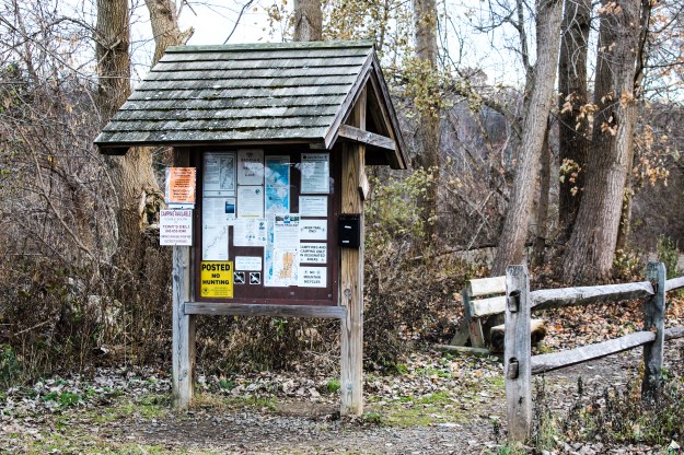
A small kiosk with trail information.
Happy Hiking!!!
“Now I see the secret of making the best person, it is to grow in the open air and to eat and sleep with the earth.”
– Walt Whitman
“Study nature, love nature, stay close to nature. It will never fail you.”
– Frank Lloyd Wright
Although the summer isn’t officially over for about three weeks, I return to work as a teacher tomorrow. What does that mean? That means summer hiking is pretty much done. I am hoping that I will be able to get out when I can, but the wonderful morning hikes that I have enjoyed the last couple of months will fade as quickly as the summer has.
Without a doubt, this summer has really been a good one for hiking. Although it has been filled with many rainy days, that was far outweighed by the beautiful mornings filled with blue skies and nice cool temperatures. This post is going to quickly cover my three favorite hikes of the summer. If you have been following my posts this summer, this list shouldn’t really surprise anyone!
Number One-Anthony’s Nose:
This should not come as a surprise to anyone. Going to the Nose has been a source of refuge, peace and tranquility for many, many years. When I have good days, bad days and really bad days, the Nose has always been there. That’s all I have to say about that….

Almost a perfect view!
Number Two-Ward Pound Ridge Reservation
This is a newcomer to my favorite list. In the past couple of weeks I have really come to love hiking here. Well maintained and blazed trails make hiking a really nice experience. With the marked trails as well as the connector trails, you can shorten or lengthen a planned hike any number of ways. And if you don’t eat during your hike you can take advantage of the numerous picnic tables that are situated throughout the reservation. I am really excited about getting out there in the fall when the leaves change colors.

The gateway to my favorite hikes in Ward Pound Ridge Reservation. The gateway to peace and tranquility!
Number Three-Bear Mountain
Located directly across the Hudson River from Anthony’s Nose, this hike has it all. Thigh numbing climbs, views up the Hudson, down the Hudson and all the way to NYC (if the weather permits).

With the incredible amount of hikes in this area as well as thinking about the ones that I did this summer, it was difficult to pick my favorite ones. The ones that made my top three list were the ones that I have developed an affection for. Ones where I know I can go to recharge the batteries or just find some peace. They vary in length, but that isn’t the most important thing-keeping my peace of mind is.
“My sense of satisfaction grew as I crested the hill and saw the Appalachian Trail stretch out in front of me.”
-MPD
“Hiking is the best workout! You can hike for three hours and not even realize you’re working out. And, hiking alone lets me have some time to myself.”
“Hiking and happiness go hand in hand or foot in boot.”
Last night I went to my fourth Phish show in just over a week. If you are not aware, tonight will be night number nine of a thirteen night run for the band at Madison Square Garden. These shows provide me with the same type of Zen that hiking does. As with hiking, the music allows my mind to wander and to block out the stress of the day.
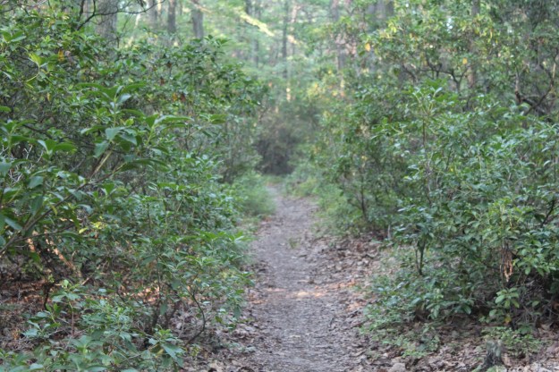
Yesterday’s hike started out at the intersection of route 9 and route 403 where the Appalachian Mart is located. Starting out on the AT, the trail begins a slow and gentle climb for a just over a quarter of a mile. Turning sharply left, the climb now becomes a bit more demanding. Heading up through the woods with the sweat now streaking my shirt, I stopped for a quick water break and to take a picture of the climb.
The AT at the start of the hike.

The AT as it begins its ascent.
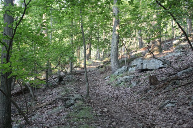
The AT during a moderate climb.
The AT as it meanders through the woods of the Hudson Highlands.
Once you get to the end of the climb, the AT joins the Blue Blazed Osborne Loop trail where they will remain together until the AT heads off to the left to continue towards Bear Mt. and the loop moves off to the right.
The Osborn Loop
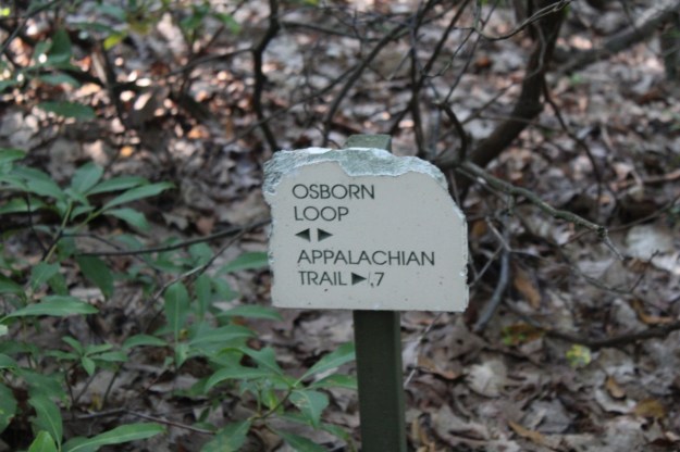
A small marker where trails from Manitoga intersect with the Osborn Loop.
A little over half way through the hike you will see the sign above. Trails from Manitoga join up with the Osborn loop or you can hike to your right and meet up with the AT in .7 of a mile. You can learn more about Manitoga here-www.visitmanitoga.org


More of the Osborn Loop.

Overall this was a pretty decent hike and a great way to prepare for seeing what will be another awesome Phish show!
Happy Hiking!
Summer 2017 Mileage:
8/1/17-7.2-87.02
“Thoughts come clearly while one walks.”
-Thomas Mann
“Never trust a thought that didn’t come by walking.”
-Friedrich Nietzsche
As the week has progressed, the temperature and humidity in the Hudson Valley has risen into the 90’s. Being as hot and humid as it is supposed to be, I decided not only to keep today’s hike relatively short, but also something familiar. Soooo…..another trip to the Nose seemed to be in order.
When I started the hike at 5:50 am, the temperature was already over 70 and the dew point was equally as high. Needless to say, it wasn’t long before I was sweating buckets! Even at this early hour, the hiking wasn’t easy with the oppressive air sitting right on top of you. But once you get to the top, it makes it all worthwhile.

A hazy morning on the Nose.
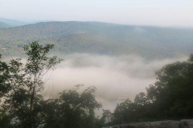
Looking Northeast from the Nose.
Summer 2017 Mileage:
7/19/17-3.7-54.62
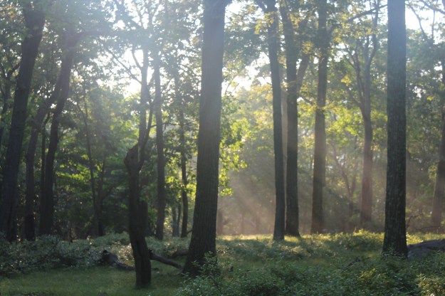
“Nothing is more beautiful than the loveliness of the woods before sunrise.”
-George Washington Carver
Every summer I feel the need to torture myself by doing two pretty difficult hikes at least once. The first one is Mt. Beacon and the second is Bear Mt. Today I decided to get Bear Mt. out of the way since the forecast for tomorrow is for the mid 80’s with high humidity. Starting off on the Appalachian Trail by Hessian Lake, the trail begins a grueling ascent immediately. The elevation at this point is 175 feet, but in less than two miles you climb 1,130 feet where you will be at Perkins Memorial Tower that has an elevation of 1305 feet.
Since they rerouted the AT over the last few years and have made significant improvements, although steep, the trail is a pleasure to hike on.

It climbs…
And climbs…

And climbs some more…

It seems like it never ends!
The AT does eventually turn off onto Perkins Memorial Drive. Instead of heading back into the woods, I stayed on the road so I could take some pictures. Part of the reason I was up here in the first place was to catch the sun coming up behind Anthony’s Nose. Unfortunately I missed it by about fifteen minutes!

Iona Island is at the bottom of the picture. The city of Peekskill, NY is in the distance.
The Bear Mt. Bridge and Anthony’s Nose just after sunrise.

Looking north on the Hudson River
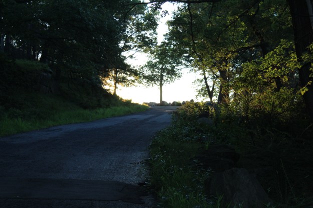
Perkins Memorial Drive
Once you get to the top where the tower is located, you will get some amazing views. This one in particular because usually this time of year the haze blocks the NYC skyline.
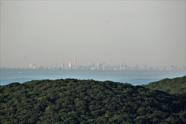
The NYC Skyline

Due to the fact that improvements on the AT have moved closer to Perkins Memorial Tower, they have had to reroute part of the trail until it is completed.


Hessian Lake at the base of Bear Mountain
Summer 2017 Mileage:
7/10/17-5.4-34.22
“As a single footstep will not make a path on the earth, so a single thought will not make a pathway in the mind. To make a deep physical path, we walk again and again. To make a deep mental path, we must think over and over the kind of thoughts we wish to dominate our lives.”
-Henry David Thoreau
Today I decided to keep the hike kind of short. I parked my car in the Lake Tiorati lot and made my way up the blue connector trail that joins up with the Appalachian Trail in three tenths of a mile. Turning left, I immediately saw a Doe with her Fawn. This in itself isn’t so strange, but when they didn’t run as I approached, I thought it would be nice to get a picture.
As I took off my pack and took out my camera, fawn actually approached me and stopped about fifteen feet away!

Mama and baby checking me out!

I was actually very surprised that neither deer ran when they saw me.
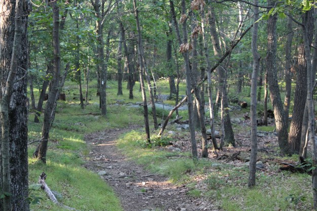
Continuing on the AT, it was much nicer terrain than when I was on the trail the other day. Today’s section of the trail was wide open and I didn’t experience the closed in feeling that I did hiking around Silvermine Lake!

The AT runs parallel to Lake Tiorati in Bear Mt. State Park.
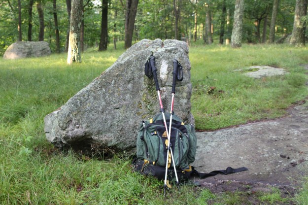
My trusty pack on the AT!!!!

Shortly after I took this picture, the AT would intersect with a blue blazed trail that leads to the Fingerboard Shelter 350 feet away.


Four tenths of a mile after passing the shelter, you end up back on Seven Lakes Road. Turn left and walk along the road (approximately 1 1/4 miles) and you end up back where you started.

Lake Tiorati
Summer 2017 Mileage:
7/8/17-3.5-28.82
“Let me live where I will, on this side is the city, on that the wilderness, and ever I am leaving the city more and more, and withdrawing into the wilderness.”
-Henry David Thoreau
“Once in awhile, climb a mountain or spend a week in the woods. Wash you spirit clean.”
-John Muir
“Life is better in hiking boots.”
-Every hiker
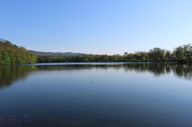
Located about 2 miles on Seven Lakes Drive, Silvermine Lake is currently a fishing, picnicking and hiking area in Harriman State Park. Back in the late 70’s and early 80’s, it used to be a pretty popular area for families to go for the day to just hang out and have a good time. As a child I have fond memories of going to this lake and running through the woods, skipping rocks on the water and eating many hot dogs!
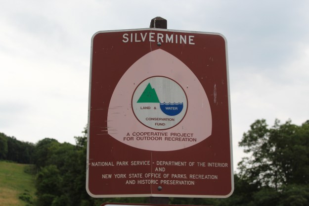
A sign on the Menomine Trail next to Silvermine Lake.

After leaving your car, head towards the lake and you will see a yellow blaze on a rock. This is the Menomine Trail, the one that you will follow until you reach the William Brien Shelter where you will then begin hiking on the dually blazed Appalachian/Ramapo Dunderberg Trail.
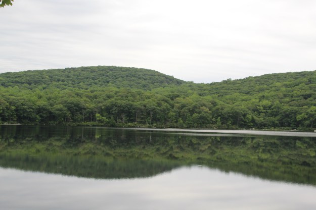
Silvermine Lake at the beginning of the hike.
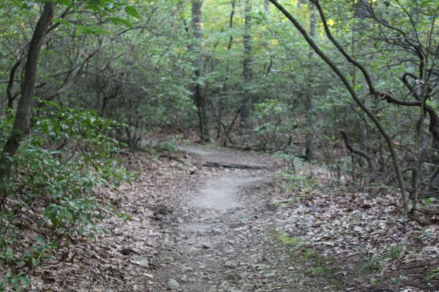
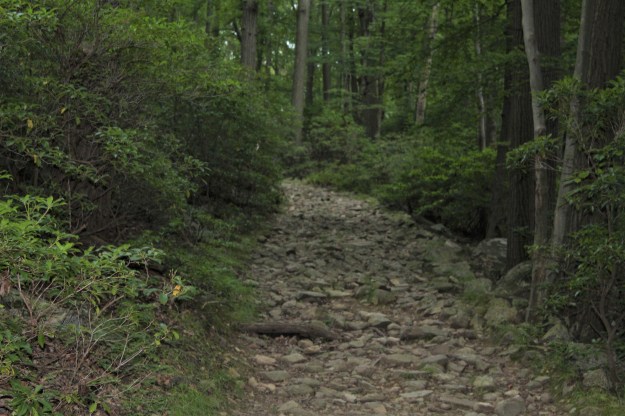
As you enter the woods and wind around the lake, the trail has its fair share of ups and downs on some very rocky terrain.

The trail before a steady steep climb.
As the trail veers off to the left, you begin a steady and then very steep climb until you reach the shelter.

The start of what turned out to be a killer climb!
The second section of the climb. I thought once I reached the top where it curves left, the climb would be over.

I was wrong. It only got worse…This is the last section of the climb.
Once you get to the top, the William Brien Memorial Shelter is on your left.
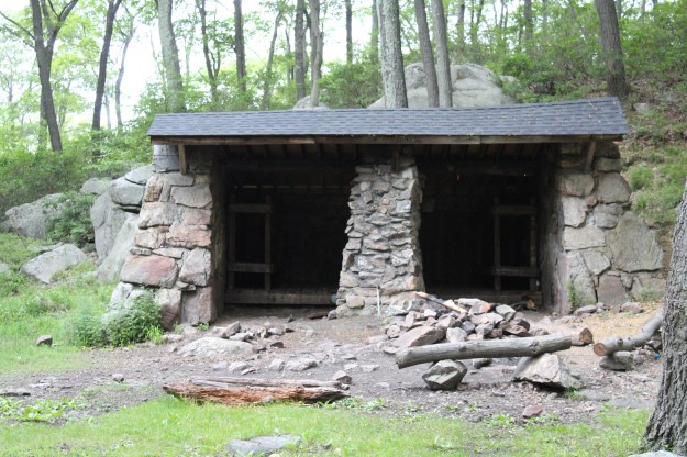
The William Brien Memorial Shelter
As I mentioned earlier, once you get to the shelter you would leave the Menomine Trail and continue hiking on the Appalachian/Ramapo Dunderberg Trail. Turning left, you immediately begin another steep climb, this time pretty short.

Appalachian/Ramapo Dunderberg Trail
You will follow the AT until you reach a woods road. Turning left, you begin a steady descent until you reach the lake.
After returning to Silvermine Lake, I had some extra time so I decided to follow the Menomine Trail in the opposite direction.

A strange looking tree…

The trail covered in pine needles.
HAPPY HIKING!!!!!
Summer 2017 Mileage:
7/6/17-5.5-25.32
