Tag Archives: hiking quotes

Silvermine (6)

“Let me live where I will, on this side is the city, on that the wilderness, and ever I am leaving the city more and more, and withdrawing into the wilderness.” 

-Henry David Thoreau

“Once in awhile, climb a mountain or spend a week in the woods. Wash you spirit clean.”

-John Muir

“Life is better in hiking boots.”

-Every hiker

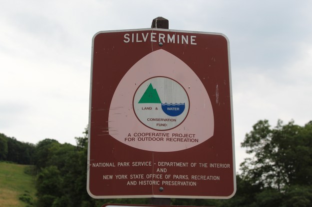
Located about 2 miles on Seven Lakes Drive, Silvermine Lake is currently a fishing, picnicking and hiking area in Harriman State Park. Back in the late 70’s and early 80’s, it used to be a pretty popular area for families to go for the day to just hang out and have a good time. As a child I have fond memories of going to this lake and running through the woods, skipping rocks on the water and eating many hot dogs!

IMG_6796

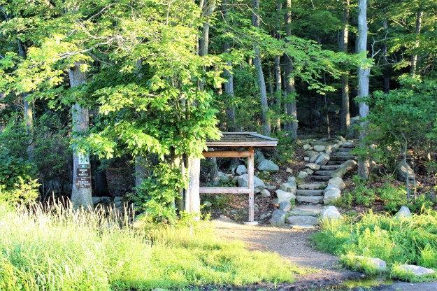
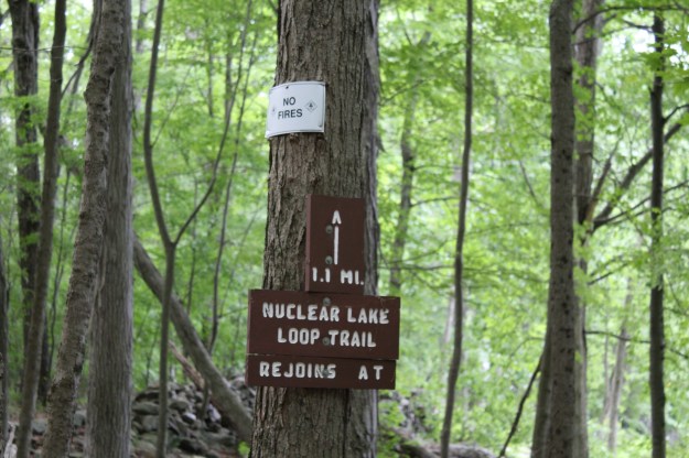
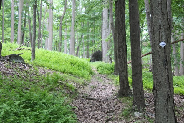
A sign on the Menomine Trail next to Silvermine Lake.

IMG_6798

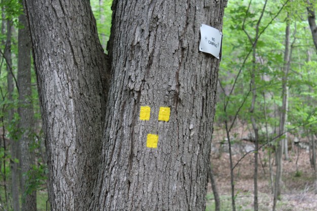
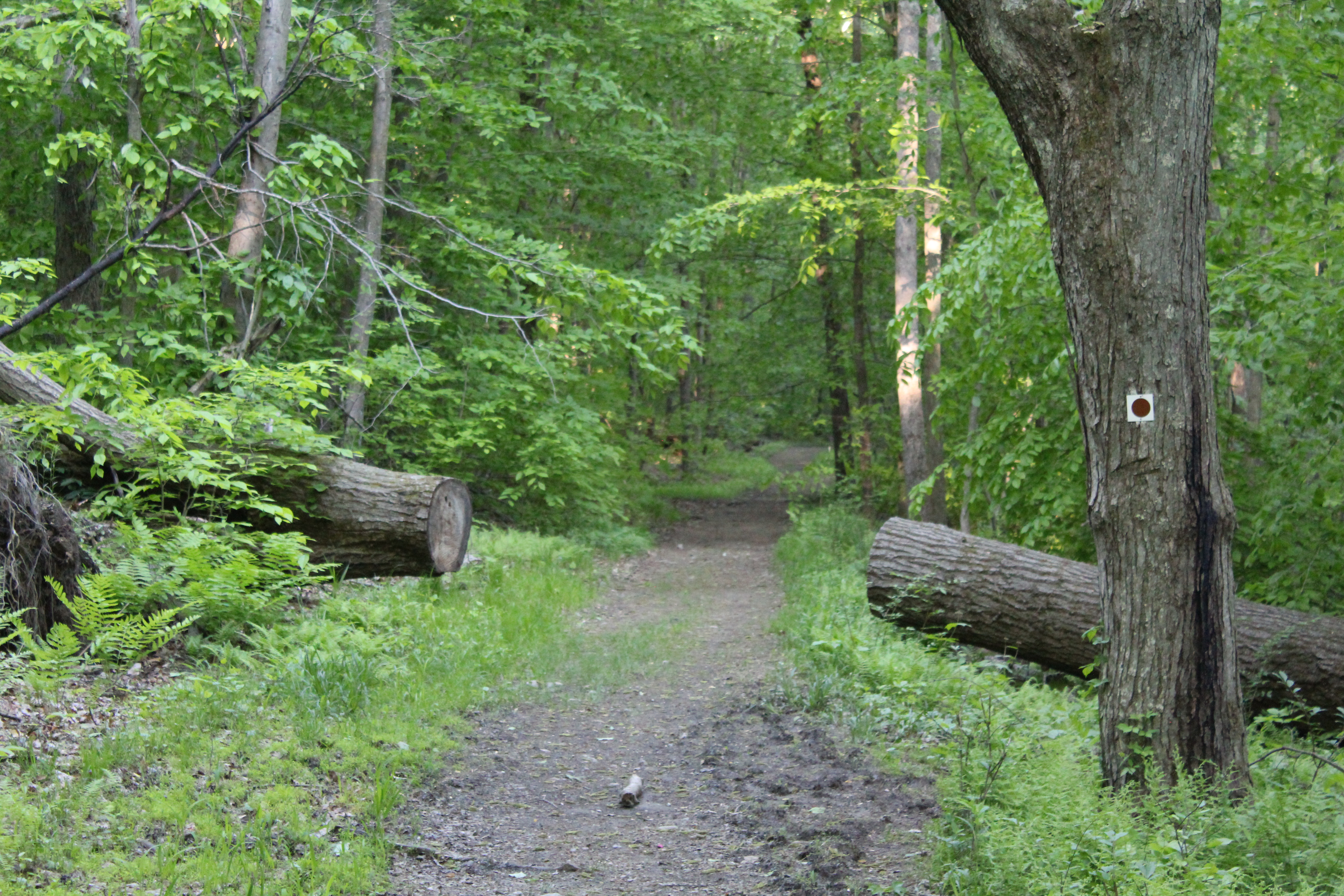
After leaving your car, head towards the lake and you will see a yellow blaze on a rock. This is the Menomine Trail, the one that you will follow until you reach the William Brien Shelter where you will then begin hiking on the dually blazed Appalachian/Ramapo Dunderberg Trail.

IMG_6802

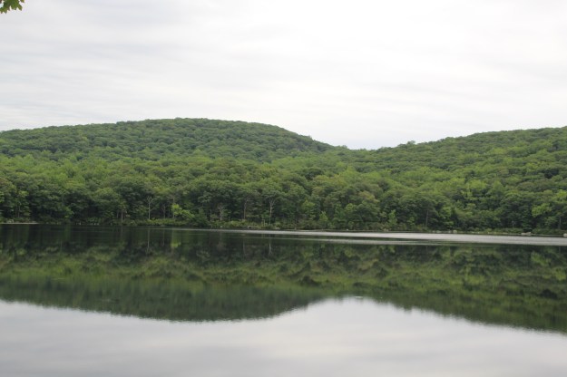
Silvermine Lake at the beginning of the hike.

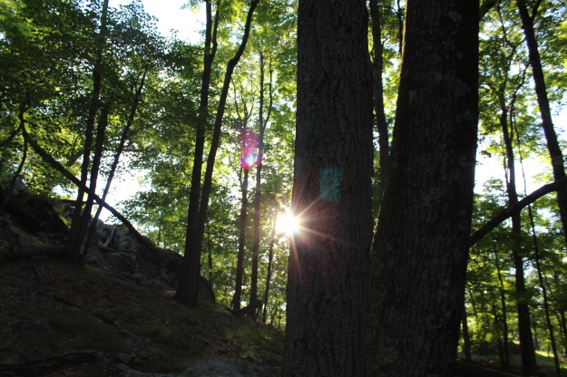
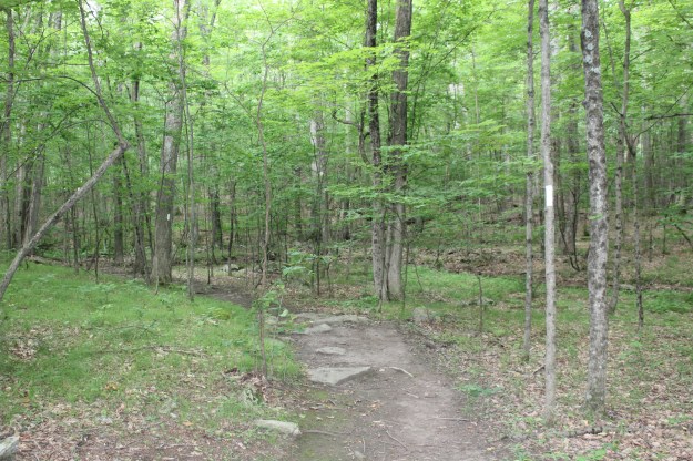
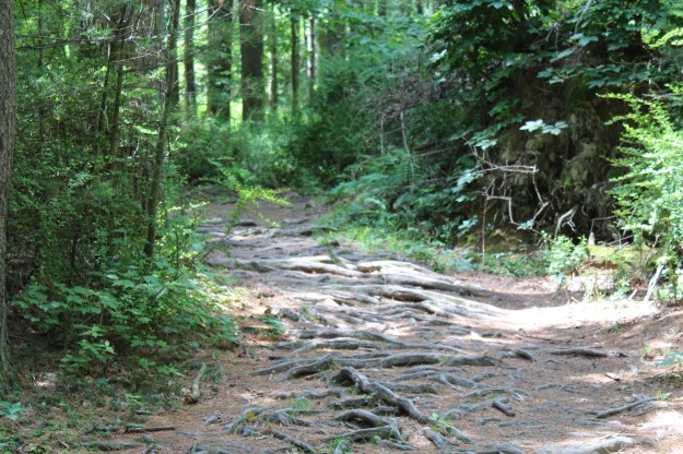
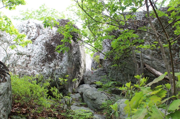
As you enter the woods and wind around the lake, the trail has its fair share of ups and downs on some very rocky terrain.

IMG_6804

The trail before a steady steep climb.

As the trail veers off to the left, you begin a steady and then very steep climb until you reach the shelter.

IMG_6806

The start of what turned out to be a killer climb!

IMG_6807

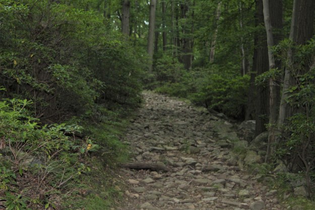
The second section of the climb. I thought once I reached the top where it curves left, the climb would be over. 

IMG_6808

I was wrong. It only got worse…This is the last section of the climb.

Once you get to the top, the William Brien Memorial Shelter is on your left.

IMG_6809

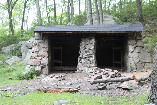
The William Brien Memorial Shelter

As I mentioned earlier, once you get to the shelter you would leave the Menomine Trail and continue hiking on the Appalachian/Ramapo Dunderberg Trail. Turning left, you immediately begin another steep climb, this time pretty short.

IMG_6810

Appalachian/Ramapo Dunderberg Trail

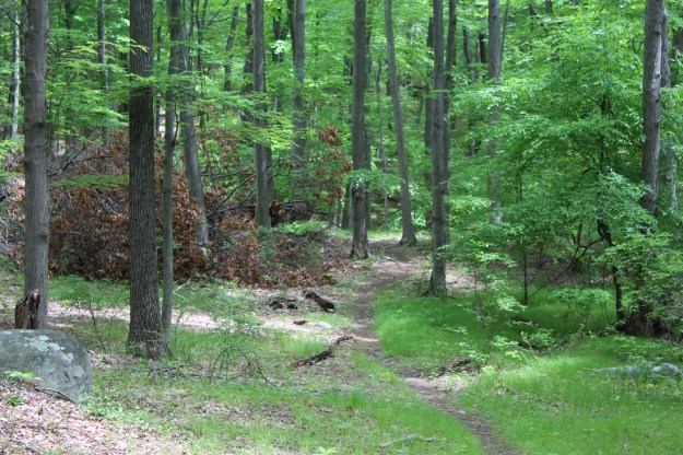
You will follow the AT until you reach a woods road. Turning left, you begin a steady descent until you reach the lake.

After returning to Silvermine Lake, I had some extra time so I decided to follow the Menomine Trail in the opposite direction.

IMG_6813

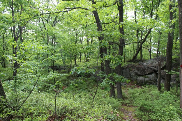
A strange looking tree…

IMG_6812

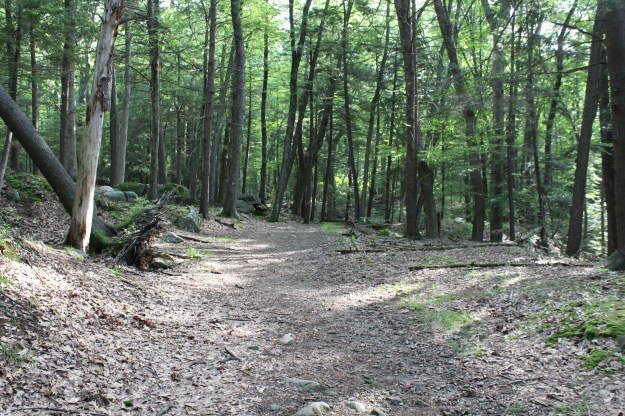
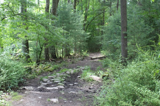
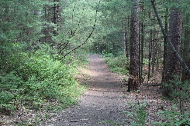
The trail covered in pine needles.

HAPPY HIKING!!!!!

Summer 2017 Mileage:

7/6/17-5.5-25.32

Iron Mines Short Loop (4)

“Hiking is the answer. Who cares what the question is.

-Anonymous

“I walk, I look, I see, I stop, I photograph.”

-Leon Levinstein

After resting my ankle for three days, I decided it was time to get back out into the woods. The swelling was gone and it felt pretty good so I figured at the very least I would lace the boots up and if it hurt too much I could just turn around and end today’s hike early.

As you pull into the parking lot, this is your view.

IMG_6763

Lake Skannatati

As is the norm with most of my summer hikes, I got the parking area pretty early today. Since it is the day before Independence Day, I thought that even at this hour more people would have been out. But at 6:10 am, the only other person I saw was this guy fishing!

IMG_6768

To the right of the lake you immediately see a kiosk and two trails. This will be the start as well as the end of the hike. The blue blazed Long Path is on your left and the red triangle A-SB (Arden Surebridge) will be on your right.

IMG_6770

The beginning and end of the hike.

Starting on the Long Path, you will wind your way around the lake, mainly staying on even ground. As you move deeper into the woods, you begin a series of small ups and downs on the trail until you intersect with the yellow blazed Dunning Trail. If you are looking for an even shorter hike than this one, you could make the right onto this trail and it will eventually intersect with the A-SB trail. Instead, take a left and after a few minutes the Long Path will turn off to the right while Dunning Trail stays on the left.

IMG_6777

The Long Path intersects with the Dunning Trail

Staying on the LP, you begin a steady climb until you reach the A-SB trail.

IMG_6775

The blue blazed Long Path

IMG_6778

IMG_6779

Red Triangle A-SB Trail

IMG_6781

Heading down the A-SB Trail back towards the lake.

Once you turn onto the A-SB trail, it’s mainly all downhill until you get to the lake.

Overall I enjoyed this hike. The difficulty rating of moderate that I have seen in its description seems appropriate. The only negative thing that I can see with it, and this has been an issue with the Long Path in the past is the way that they blaze the trail. While I was on the LP today I spent way to much today not being able to find blazes and I had to reroute myself several times.  They could definitely put some of the blazes closer together and at critical junctures make it easier to follow them.

Summer 2017 Mileage:

7/3/17-4.3-16.02


Nuclear Lake (3)

“Fill your life with experiences, not things. Have stories to tell, not stuff to show.”

-Anonymous

Before I even begin to describe this hike, I think I spent too much time telling you how good my new boots were. The reason I say this is because about half way through the hike (approximately 2 miles), I went to step up with my left foot and with my right foot on an uneven tree root, it slid to the left, twisting my right ankle and sending me to the ground. Of course I really can’t blame the boots, but why blame my own clumsiness??

Since I was in the middle of the woods, I had no choice but to keep going. Up, down and over rocks, tree roots and leaves I went, the pain increasing with every step. I really  wanted to stop, but I knew that wasn’t possible. So I forged ahead for the remaining two miles and finished the hike.

Wow…I certainly am not a baby when it comes to pain, but this really hurt. I’m confident it isn’t broken, but it certainly is sprained. So as I sit on my couch with my foot up on a pillow with a bag of vegetables as an ice pack, I’ll describe what still was a really nice hike! Unfortunately I’ll be of the trails for a few days to let my ankle rest.

Parking just off of route 55 in a small parking lot, the initial blue trail lasts from the parking area until it joins the AT. A kiosk just off of the parking lot has a map for the nuclear lake hike as well as the obligatory warning about ticks.

IMG_6734

The start of the Nuclear Lake hike.

IMG_6736

Map of today’s hike.

Within a minute or two of leaving the kiosk, you will see the AT. Stay to the left on the AT and begin your journey through the woods. After about 5 minutes you will see the blue blazed Beekman Uplands Loop on the left. Do not take this trail! That is a hike for another day.

IMG_6738

The AT runs through some very nice woods.

The two bridges below make for pleasant distraction as you meander through the woods.

Almost immediately after crossing the bridge on the right, you will see this sign on a tree off to the right of the AT.

IMG_6742

The start of the yellow blazed Nuclear Lake Loop Trail.

IMG_6744

A section of the trail.

Photos of Nuclear Lake.

IMG_6748

The Nuclear Lake Loop

IMG_6758

As you circle the lake you cross several interesting rock walls.

Keep following the Yellow Blazes until you reach the point where the loop ends and meets up with the AT again. Take the left and continue on the AT until you get back to the blue trail that leads back to the parking lot.

IMG_6755

The end of the Nuclear Lake Loop Trail.

IMG_6756

IMG_6759

A stretch of the AT.

IMG_6760

The AT goes back into the woods.

Summer 2017 Mileage:

4.2-11.72


Summer’s First Hike (1)

“We don’t stop hiking because we grow old-we grow old because we stop hiking.”

-Finis Mitchell

“I could never resist the call of the trail.”

-Buffalo Bill

The first hike of the summer season!!!!

I headed out to the Horn Hill Bike Path after publishing my previous post to start breaking in my new Vasque boots. Overall they did well. They were comfortable and I didn’t really experience any discomfort until close to the end of the hike. Not much, but exactly what I would expect from a new pair of boots. No twisted ankles, blisters or hot spots.

I decided to do the shorter loop of this hike and it truly is amazing how it changes throughout the year. I have documented this hike in just about every season and with the amount of rain we have had recently, everything is in full bloom.

IMG_6673

The kiosk at the start of the hike.

IMG_6681

The smell of pine was intoxicating on several sections of this hike!

IMG_6682

More pine…

IMG_6685

The only short hill on this hike.

IMG_6691

This wasn’t here the last time I was here.

IMG_6693

IMG_6676

Although these roots can be perilous, they are cool to look at!

IMG_6677

The trail near the end of the hike.

Summer 2017 Mileage:

3.85-3.85

The Catfish Loop Trail

“Hiking is a bit like life:

The journey only requires you to put one foot in front of the other…again and again and again. And if you allow yourself the opportunity to be present throughout the entirety of the trek, you will witness beauty every step of the way, not just at the summit.”

-Anonymous

“Remember to turn everything off once a week including your brain and walk somewhere quiet.”

-Anonymous

Today’s hike, located just across the street on Dennytown Road from the parking lot, was a decent one. It started on the Appalachian Trail and after 100 ft made a right turn onto the Catfish Loop Trail. Five miles of up, down and all around!

IMG_6579

IMG_6558

Just cross the street to start the hike.

IMG_6559

The trail as it heads deeper into the woods.

IMG_6560

And deeper…

IMG_6562

The view to the left as I made my way down a hill.

IMG_6567

At the bottom of a hill.

IMG_6569

IMG_6570

The trail went on like this for about 1.5 miles.


IMG_6576

A little scramble through this tight space.

IMG_6578

Almost at the end of the hike.

Anthony’s Nose in the Spring

“Take only memories, leave only footsteps.”

-Chief Seattle

With spring upon us it can only be assumed that I would make a trip to Anthony’s Nose. For mid April (4/10/17), the weather was perfect and the trail was as beautiful as you would imagine it would be. What also made this hike special was my fifteen (almost sixteen) year old daughter asked if she could come hiking with me. I almost fell over with surprise. Because of hockey, “I’m tired,” and “I have too much school work,” she really hasn’t been out with me much the last couple of years so this was really nice.

One quick side note-As we sat at the top taking pictures, several people made their way from the trail to the view-point. As one group sat and ate a snack, three young ladies arrived and started taking pictures of each over looking the Bear Mt. Bridge. Normally I wouldn’t even give this a second thought, but when they started giving each other directions such as, “lift you leg,” “turn to your left” and “fix your hair,” I literally began to laugh out loud. Even my daughter, who is obviously much closer in age to them as I am, found this amusing as well.

Please don’t get me wrong, I take pictures while I am hiking all of the time. You have seen many of them here on this blog. But posing for pictures like you are on a model shoot to me is over the line. And…after ten minutes of posing for pictures, one of the young ladies turned, posed and then said to her friends, “Is this hikey enough?” Oh boy…

I have no idea why this bothers me so much.

Anyway, here are pictures of yet another hike to Anthony’s Nose.

IMG_6203

A brook at the beginning of the hike.

IMG_6197 (3)

A small pond filled with fresh rain and melted snow.

IMG_6190 (2)

A freight train heading north on the Hudson River.

IMG_6181

Perkins Memorial Tower at the top of Bear Mt., approximately 300 feet higher than Anthony’s Nose.

IMG_6179

Old glory standing stiffly, crimson white and indigo.

IMG_6174

A wide shot of Bear Mt. as seen from the Nose.

The First Hike Of 2017!

“Without new experiences, something inside of us sleeps. The sleeper must awaken.”
-Frank Herbert

“Now I see the secret of making the best person, it is to grow in the open air and to eat and sleep with the earth.”
-Walt Whitman

It’s been awhile since I was able to get out for a hike on the last day of the old year and the first day of the new. Since both days were beautiful, I really had no excuse  not to get out into the woods. Sunday January 1st was  a clear crisp day in the low to mid 40’s. Compared to my hike on 12/31, the trail here was not covered with ice, which made it much easier to get around.

Starting on a side road just north of the Appalachian Market at the split of Route 9 and 403, we hiked back south on Route 403  for a few hundred yards where the AT crosses the highway and the goes south.

img_2444

The AT moving steadily uphill. The picture was taken about 1 mile from where it crosses Route 9.

img_2446

Looking back down th AT.

Once you get to the top of the hill after a steady 1.5 mile climb, make a left on the AT and proceed south on the now white marked AT and blue blazed Osborne Loop Trail. About 200 yards farther south, you will see a well worn trail off to the right. This leads to lookout over the Hudson.

img_2448

The Hudson River looking south.

img_2450

The Hudson River looking north.

After spending some time at the view point, we got back on the trail and headed north on the AT/Osborne Loop back to where the AT heads north and the Osborne Loop continues moving downhill. After another mile, the Osborne Loop tuns left and keeps heading downhill. After walking for five minutes you come upon this wooden gazebo. It has been there for many years and was restored in 1996.

img_2452

img_2453

The Osborne Loop headed towards Sugarloaf. Notice the gazebo on the right.

img_2457

Enter a caption

img_2458

img_2459

img_2461

The ceiling of the gazebo.

img_2468

Photo taken from the gazebo.

img_2471

After you spend some time at the gazebo, keep heading down the trail, you will see red blazes marking the Sugarloaf Hill trail. Make the left onto this trail and head steadily uphill. The trail here is pretty difficult but the climb is worth it.

img_2477

As you look south on the Hudson, you can see Anthony’s Nose on the left.

img_2490

img_2501

img_2502

After descending the hill, you will go back the way you came on the blue trail for a short period of time. Instead of turning right and heading back uphill on the blue trail, you will continue on the yellow blazed carriage connector trail. You will stay on this trail until it intersects with the AT. Follow the AT out to Route 9 and you are finished!

img_2505

The rest of the photos here and below were taken on the yellow blazed carriage connector trail.

img_2507

img_2508img_2509

Needless to say this was a great way to start not only the calendar year, but the hiking new year as well! Six and half miles with a couple of pretty intense climbs and some great views make it al worthwhile!

Happy hiking everyone!!!


A Winter Hike to the Nose

“Winter is a season of recovery and preparation.”

-Paul Theroux

“He who marvels at the beauty of the world in summer will find equal cause for wonder and admiration in winter.”

-John Burroughs

“Let us love winter, for it is the spring of genius.”

-Pietro Aretino

You know it’s going to be a good hike when your long time hiking buddy shows up at the trail head and after a good twelve hours of snow, freezing rain and rain, it all just stops! Ten minutes later the sun is out. You couldn’t ask for anything better.

Yes, I headed back up to Anthony’s Nose on a day that started off slushy, icy and nasty. As I looked up the trail, I have to admit that I was a little worried noticing that it was all a sheet of ice. With that said, after about 200 yards, the trail became more slushy which made it much more manageable.

img_2327

12/24/16-The start of the climb to Anthony’s Nose. 

img_2325

12/24/16-A quick 180 degree turn from the picture above looking back towards the start.

Since I have not been up to the Nose this late in December for a couple of years, I really forgot about how the views drastically change now that the trees are bare. You get an entirely different perspective on winter hiking.

img_2326

12/24/16-A view you would never get during the summer!

img_2331

12/24/16-The Nose in the distance as seen from the Appalachian Trail. This is the only time of year you get this view of the Nose.


Once I got to the top I was pleasantly surprised with the awesome views that were waiting. for me! The difference between pictures during the summer and now are incredible. Once again, this is why I love this hike!

img_2334

12/24/16-Iona Island to the lower left and Bear Mt. to the right.

img_2335

Dunderberg Mt.

IMG_2337.JPG

Bear Mt. and the Bear Mt. bridge to the right.

img_2341

img_2347

img_2369

img_2360

img_2361

img_2367

Bear Mt. 

img_2371

Another viewpoint, just off of the Nose looking North towards West Point.

img_2372

Sugarloaf as seen from the alternate viewpoint.

img_2373

A tighter view looking North on the Hudson.

img_2374

A small pond, now frozen, that you see on the way up and down from th Nose.

As always, any hike to the Nose is a good one. If you want to, go back to my posts in July and August to get a good look at the differences in the terrain depending on the season.

Happy Hiking!!!