Tag Archives: Hike

Sunday At The Reservation

“I slow down when hiking. The rhythm of nature is more leisurely. The sun comes up, it moves across the sky, and you begin to synchronize to that rhythm.”
-John Mackey

It was another beautiful morning in the Hudson Valley. I would really love it if it were about 15 degrees cooler, but that’s ok, it’s just good to get outside. As you can see below, the sunrise was spectacular and an outstanding way to start today’s hike.

The most important thing that I have come to love about Ward Pound Ridge Reservation is the flexibility that you have in determining the length of hikes. With the marked trails and the plethora of connector trails, you never have to do the same hike two times in a row. Going in the opposite direction of what you are used to also adds to the diversity of what the reservation offers.

So to mix things up today I traveled the initial mile on the Red Trail and then made a right turn on a connector trail. This trail took me to the Leatherman’s Loop Trail which I stayed on until it returned to the Red Trail. Almost immediately after getting back on the Red Trail, another connector trail veered off to the left and traveled through the woods until it came back again to the Red Trail. You then stay on the Red Trail until the finish.

WP_20170924_001

Happy Hiking!!!

2017 Mileage:

9/24/17-7.1-241.22


It’s Officially Fall!

“Our minds, as well as our bodies, have need of the out-of-doors. Our spirits, too, need simple things, elemental things, the sun and the wind and the rain, moonlight and starlight, sunrise and mist and mossy forest trails, the perfumes of dawn and the smell of fresh-turned earth and the ancient music of wind among the trees.”

-Edwin Way Teale

“Although the vast majority of walkers never even think of using a walking staff, I unhesitatingly include it among the foundations of the house that travels on my back.”

-Colin Fletcher

If you have read this blog of mine, you know that fall is my favorite time of year. Apple picking, college football, cool days, cooler nights and of course awesome hiking make every day truly magnificent. Today I was back hiking the Labyrinth at Ward Pound Ridge. As I was in sight of the finish, I felt good and decided to make the left turn onto the Yellow Trail to add some mileage.

Making my way up the trail. I pulled out the map and saw that the RT Trail would soon take me off of the Yellow trail and then put me on the Red Trail for literally a couple of hundred feet. Heading up a small hill, it then finished on the Green Trail.

001

On the Red/Green trail.

004

My trusty pack and poles leaning on my favorite resting rock at 2.5 miles. 

005

The view directly behind the rock where I take a break just before the Green trail veers off to the left.

006

The trail about one mile from the finish.

007

Some of the more interesting rock formations along the trail.

008

More of the Red Trail.


From this point on I will be listing my mileage as an accumulation for the entire calendar year. Taking the information from my blog as well as my GPS, I have calculated that prior to the first hike of the summer I had hiked 45.2 miles. I am adding that to the 181.22 that I did for the summer, giving me a total of 226.42 miles. With the addition of the 7.7 miles that I hiked today, that brings my total for the year to 234.12 miles.

2017 Mileage:

Hikes from 1/1/17-6/26/17-45.2-226.42

9/23/17-7.7-234.12

Quest

Morning sun rises

The quest an obvious one

Peace, tranquility

IMG_9333

Quest

Passion

Mad with passion, dancing, floating on soft brown earth,

Blue sky beckons, screaming naked ambition,

Traipsing through soft green tunnels that cling like a lover’s soft embrace.

Mad with passion, eyes ablaze, catching the sun’s soft rays,

The valley awakens, seeking, welcoming, fleeing the nights

Deathly stillness.

Mad with passion, the miles pass, each step marking unbridled pleasure,

A maniacal celebration of the senses, deep breaths taken in small measured stanzas,

That give into a desperate, wanting and measured desire.

Mad with passion, the miracle of the woods brings the soft kiss of the wind,

Caressing and cleansing every pore that permeates reality,

Allowing for that existence to keep moving forward.    

Black Rock Forest

IMG_9513

The sign at the entrance to the parking lot.

IMG_9515

“The clearest way into the universe is though a forest wilderness.”

-John Muir


“Hike while you can.”

-Unknown

I’m pretty sure that it’s been over ten years since I did any kind of hike in the Black Rock Forest. Since today was another one of those rare cool mornings in August, I decided to do a loop that would take me over trails and woods roads to places that I have never hiked before. Parking was easily found just off of Route 9W.

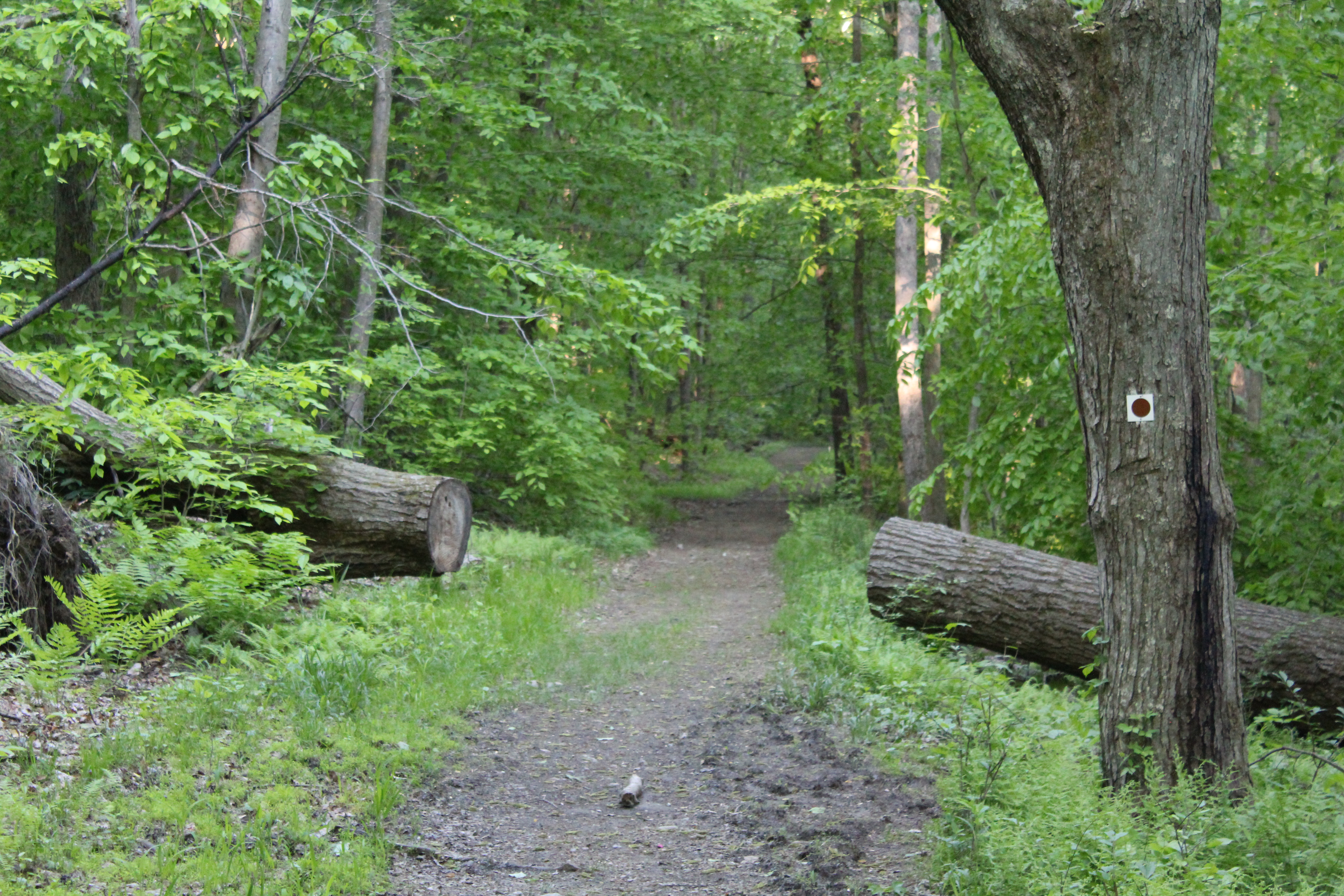
Starting on the Duggan Trail, the trail quickly descends through some pretty thick woods that had some interesting rock walls and large rocks as stepping-stones.

IMG_9444

IMG_9448

IMG_9449

IMG_9450

After following the red blazes for about a half of a mile, the trail ends and intersects with the blue blazed Reservoir Trail. Since this hike is a loop, you will encounter this trail again, this time going uphill. Crossing a woods road, you immediately come upon Ben’s Bridge, which will take you across a small stream.

IMG_9462

IMG_9459

Ben’s Bridge

IMG_9461

A closer look at Ben’s Bridge.

After crossing the stream, the trail, at this point very rocky with a lot of loose dirt, begins a steep and winding climb that parallels the stream. The trail here was pretty cool because at times it was closed in and you got a feeling as though you were wrapped in a lush blanket of summery goodness.

IMG_9466

IMG_9468

I also thought that it was great having the sound of running water to distract me from the climb in front of me. Cascading over the rocks, it calmed me and I thought how nice it would be to just be able to sit by the stream and vegetate! On this day, however, I had to keep moving. Most of the time I usually don’t mind steep climbs, but with all of the loose rocks and dirt that made up the trail, it just made it that much more difficult. After steadily climbing for a half of a mile, look to the left and you will see this:

IMG_9470


IMG_9469

Apparently the reservoirs in the Black Rock Forest still supply water to the local communities and this is one of the pipes that accomplishes that. Directly across from the pipe is this awesome sign that not only tells you what trail you are on, it also lets you know what is coming up on the trail. If only all signs on all of the trails in the area were this detailed!!!

IMG_9472

After resting for a few minutes, drinking some water and tightening my boot laces, I threw my pack on and made the right turn up the Honey Hill Trail. This trail also weaved through the woods and after just coming off of the Reservoir Trail it to proved to be a pretty steep climb. Based on all of the write ups I read preparing for this hike, I thought that a nice view was awaiting me when I reached the top! Hmm…I’m thinking that maybe the folks that wrote about the views on Honey Hill did so in the fall or winter because when I got to the top, this is all I saw.

IMG_9477

If the trees were bare I do believe that the view would have been much better than it was today. Since I didn’t have t any type of view, I immediately headed down the trail. Be careful here because it is very steep and the terrain mirrors what you have already been hiking on-loose rocks and dirt! Be mindful and watch your footing as you make your way down this section of the trail because the drop off to the right could prove to be treacherous if you slipped and fell!

IMG_9478

For our hike, keep heading to the left down towards Aleck Meadow.


IMG_9479

Steps on the descent from Honey Hill.

I have to admit that the first thing I thought when I saw this tree was Blair Witch Project. If I had been hiking close to sunset I probably would have started running. Good thing it very early in the morning!!

IMG_9482

Blair Witch Project!!!

Staying on the trail, you either descend or stay level for another fifteen or so minutes. As you continue hiking, the sound of running water becomes  louder and louder and after rounding a corner, you are presented with this stunning view.

IMG_9483

Due to recent storms that had passed through the area just two days before this hike, water was actually flowing over the dam. Based on the time of year, I had fully expected it to be dry. This made up for my Blair Witch like scare just minutes before!

IMG_9490

The trail continues right to left over the spillway on the Stillman Trail.

IMG_9493

The Stillman Trail

IMG_9495

The Stillman Trail after crossing the spillway.

IMG_9484

The dam at Aleck Meadow Reservoir

IMG_9500

Aleck Meadow Reservoir

I had first decided to make the trek to Black Rock Mountain but after looking at the map I thought it would be cool to venture instead to the White Oak Tree. The tree,  conveniently located not to far along on the White Oak Road, was worth the diversion that I had decided to take.  How often do you see a huge tree that sits in the middle of a road?

IMG_9506

White Oak Tree

IMG_9503

You can sit and rest at the White Oak Tree on this bench.

To continue on the Continental Road, do an about face  and keep hiking. I know that the Black Rock Forest Consortium uses these roads, but I never thought that I would see this sign:

IMG_9504

You will follow this woods road for almost four tenths of a mile where the Continental Road continues straight. Directly to the right,  you will see the entrance to the Hulse Road. Continue on this road for the 1.4 miles. As soon as you round the corner in the picture below, you will start to descend rapidly through the forest. At times the descent is very steep so you need to be very careful, the trail here is also very rocky and if you aren’t paying attention you could easily twist an ankle.

IMG_9509

After completing the 1.4 mile downhill extravaganza, you will find yourself on the blue blazed Reservoir Trail again. The trail starts moving uphill again, but not at the same rate as the downhill you just completed. Two tenths of a mile after rejoining the trail, you make a left hand turn and you are back on the Duggan Trail. Stay on this for a half of a mile and you are back to where you started!

IMG_9512

This small building was just off of the Reservoir Trail after leaving the Hulse Road.

IMG_9511

Even though I didn’t get the view I was expecting from Honey Hill and also bypassed Black Rock Mountain, I did get to see the Dam, Aleck Meadow Reservoir and the White Oak Tree. They all proved to be interesting in their own unique ways and I’m glad that I got some pictures on what was a beautiful day. I would love to see the dam when the reservoir is cascading over the top at it fullest and head up Honey Hill when the trees aren’t fully obscuring what I am sure is a magnificent view! It looks like I may be doing this hike a few more times this year to see what I can see. Another excellent hike!!!

Happy hiking folks!!!!

Peace!


Rare (weekly photo challenge)

What is it about this photo that is rare? The day this photo was taken, it was around 60 degrees with no humidity. In the state of New York in late July, this makes days like this very, very rare!

IMG_8999

Rare

The Nose in Black and White

“In every walk with nature, one receives far more than he seeks.”

-John Muir

“In all things of nature there is something of the marvelous.”
–Aristotle

“Details of the many walks I made along the crest have blurred, now, into a pleasing tapestry of grass and space and sunlight.”
–  Colin Fletcher

Today (8/2/16) I went to Anthony’s Nose again. Since I have written about my travels to the Nose several times, I am finding it more and more difficult to find ways to describe and chronicle just how great this hike is. As you may or may not know, my hikes to the Nose are what I use to get my mind straight. It doesn’t matter that I have traveled from South Mountain Pass to the Nose countless times, the anticipation and eventual hike are always physically demanding but at the same time mentally soothing.

In order to give you all a little bit of a different perspective of the hike to the Nose, all of the pictures that I took today are in black and white. I will admit that I do have a preference for B & W photos, so I look forward to seeing what you think.

IMG_9178

South Mt. pass at the start and end of the hike.

IMG_9174

The AT headed up to the Nose

IMG_9176

The view off of the AT into the woods.

IMG_9160

More climbing as you make your way up.

IMG_9156

IMG_9154

Just to the right on the road is Camp Smith, a National Guard training facility. It is clearly marked as being “Off Limits.” You will be arrested if you are caught trespassing!!!!!

IMG_9152

On your return from the Nose this will be your final climb of the hike.

IMG_9150

IMG_9143IMG_9137

One of the things that I really have not mentioned in any of my posts is that there is a viewpoint almost at the Nose where you have this incredible view looking north on the Hudson River.

IMG_9134

Although you can’t see it, West Point is located on the left side of the picture.

IMG_9133

Sugar Loaf Mountain (another excellent hike)

IMG_9132

A wider view taken from the same spot as the first picture.

Five minutes away from this viewpoint is Anthony’s Nose. Here are some pictures taken of Bear Mt., Iona Island, The Torne and the Bear Mt. Bridge.

IMG_9126

The Bear Mt. Bridge is obviously to the right with Bear Mt. to the left of the bridge and the playing fields are all of the way on the left of the picture. 

IMG_9119

The Torne

IMG_9128

A hat without a head.

IMG_9124.JPG

IMG_9112

Looking south towards NYC

IMG_9107

A final view of Bear Mt.

So another excellent hike to the Nose ends. I hope that you enjoy the pictures, as different as they may be.

Happy hiking!!!!!!


A Photo a Week Challenge: Out in the Country

IMG_8999

IMG_9049

Both of these pictures were taken at two different points in a hike that I took last week. The theme, “Out in the Country,” is well represented here in both photos by showing the isolation of being out in the country.

Narrow

IMG_8859 (1)

“The clearest way into the Universe is through a forest wilderness.”

John Muir

Heading out into the woods anywhere in the Hudson Valley promises each person a wide variety of trails that are naturally built into each hike. Some are wide and can accommodate several people walking shoulder to shoulder, while others, as seen in the photo above must be traveled in a single file.  Hiking on narrow trails, especially when they go on for some length, provide you with a sense of not knowing what it going to come next. Will the trail open up? Will it stay the same? When I venture out and encounter long stretches like this, it feels like being wrapped in a warm blanket. Soft, secure and peaceful.

Narrow

Summer Hiking (A Shadorma)

Hiking on

welcoming soft earth

a slight breeze

to bring me

closer to tranquility

and I feel renewed.