Tag Archives: Henry David Thoreau

Lake Tiorati (7)

“As a single footstep will not make a path on the earth, so a single thought will not make a pathway in the mind. To make a deep physical path, we walk again and again. To make a deep mental path, we must think over and over the kind of thoughts we wish to dominate our lives.”

-Henry David Thoreau

Today I decided to keep the hike kind of short. I parked my car in the Lake Tiorati lot and made my way up the blue connector trail that joins up with the Appalachian Trail in three tenths of a mile. Turning left, I immediately saw a Doe with her Fawn. This in itself isn’t so strange, but when they didn’t run as I approached, I thought it would be nice to get a picture.

As I took off my pack and took out my camera, fawn actually approached me and stopped about fifteen feet away!

IMG_6835

Mama and baby checking me out!

IMG_6832

I was actually very surprised that neither deer ran when they saw me.

Continuing on the AT, it was much nicer terrain than when I was on the trail the other day. Today’s section of the trail was wide open and I didn’t experience the closed in feeling that I did hiking around Silvermine Lake!

IMG_6838

The AT runs parallel to Lake Tiorati in Bear Mt. State Park.

IMG_6840

IMG_6841

My trusty pack on the AT!!!!

IMG_6846

Shortly after I took this picture, the AT would intersect with a blue blazed trail that leads to the Fingerboard Shelter 350 feet away.

IMG_6855

Four tenths of a mile after passing the shelter, you end up back on Seven Lakes Road. Turn left and walk along the road (approximately 1 1/4 miles) and you end up back where you started.

IMG_6859

Lake Tiorati

Summer 2017 Mileage:

7/8/17-3.5-28.82


Silvermine (6)

“Let me live where I will, on this side is the city, on that the wilderness, and ever I am leaving the city more and more, and withdrawing into the wilderness.” 

-Henry David Thoreau

“Once in awhile, climb a mountain or spend a week in the woods. Wash you spirit clean.”

-John Muir

“Life is better in hiking boots.”

-Every hiker

Located about 2 miles on Seven Lakes Drive, Silvermine Lake is currently a fishing, picnicking and hiking area in Harriman State Park. Back in the late 70’s and early 80’s, it used to be a pretty popular area for families to go for the day to just hang out and have a good time. As a child I have fond memories of going to this lake and running through the woods, skipping rocks on the water and eating many hot dogs!

IMG_6796

A sign on the Menomine Trail next to Silvermine Lake.

IMG_6798

After leaving your car, head towards the lake and you will see a yellow blaze on a rock. This is the Menomine Trail, the one that you will follow until you reach the William Brien Shelter where you will then begin hiking on the dually blazed Appalachian/Ramapo Dunderberg Trail.

IMG_6802

Silvermine Lake at the beginning of the hike.

As you enter the woods and wind around the lake, the trail has its fair share of ups and downs on some very rocky terrain.

IMG_6804

The trail before a steady steep climb.

As the trail veers off to the left, you begin a steady and then very steep climb until you reach the shelter.

IMG_6806

The start of what turned out to be a killer climb!

IMG_6807

The second section of the climb. I thought once I reached the top where it curves left, the climb would be over. 

IMG_6808

I was wrong. It only got worse…This is the last section of the climb.

Once you get to the top, the William Brien Memorial Shelter is on your left.

IMG_6809

The William Brien Memorial Shelter

As I mentioned earlier, once you get to the shelter you would leave the Menomine Trail and continue hiking on the Appalachian/Ramapo Dunderberg Trail. Turning left, you immediately begin another steep climb, this time pretty short.

IMG_6810

Appalachian/Ramapo Dunderberg Trail

You will follow the AT until you reach a woods road. Turning left, you begin a steady descent until you reach the lake.

After returning to Silvermine Lake, I had some extra time so I decided to follow the Menomine Trail in the opposite direction.

IMG_6813

A strange looking tree…

IMG_6812

The trail covered in pine needles.

HAPPY HIKING!!!!!

Summer 2017 Mileage:

7/6/17-5.5-25.32

Security

“It often happens that a man develops a deeper love and friendship with his pet cat or dog than he does with most of the other humans in his life.”

-Henry Daivd Thoreau

WP_20170320_001

Security

Morning in the Hudson Valley

“When you arise in the morning, think of what a precious privilege it is to be alive – to breathe, to think, to enjoy, to love.”

-Marcus Aurelius

“I have always been delighted at the prospect of a new day, a fresh try, one more start, with perhaps a bit of magic waiting somewhere behind the morning.”

-J. B. Priestley

“Every morning was a cheerful invitation to make my life of equal simplicity, and I may say innocence, with Nature herself.”
― Henry David Thoreau

I love the morning. Without a doubt it is the best time of every day. The peace, quiet and possibility sets the tone for what lies ahead. The success of every day is what you make it.

img_1532

img_1536

img_1539

img_1541

img_1545

The Fahnestock Special-7/20/16

“Without new experiences, something inside of us sleeps. The sleeper must awaken.”
-Frank Herbert

“I see my path, but I don’t know where it leads. Not knowing where I’m going is what inspires me to travel it.”
-Rosalia de Castro

“Let me live where I will, on this side is the city, on that the wilderness, and ever I am leaving the city more and more, and withdrawing into the wilderness.”
― Henry David Thoreau

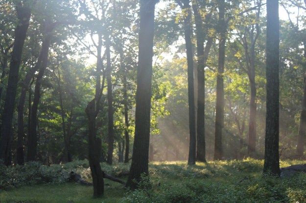
Today was a perfectly glorious day in the Hudson Valley. When I started hiking at 6:45 am, the temperature was a cool and refreshing 58 degrees with absolutely no humidity. The sky was blue and if only for the wisps of white fluffy clouds, the suns brilliance would have been absolute. For an early morning hike on July 20th, you weren’t going to get much better than this. Mornings like this are a rarity in this area for mid to late July, with days usually being much warmer and humid than what I was faced with today. Instead of being confronted with a hazy film and endless bugs that thought I was a good source of protein, the slight breeze that was present made my eventual journey into the woods a positive one

Leaving the house, the sun was slowly rising as I made my way around Lake Mahopac. I was amazed at its brilliance, but with no humidity to hinder its ascent, the warm glow basked everyone who was out shortly after sunrise.


IMG_8951

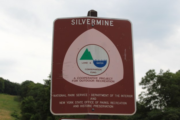
One of the  best things about hiking in Fahnestock State Park is its proximity to where I live. Traveling north on the Taconic State Parkway, it only takes 15 minutes to get from my front door to the trail head.

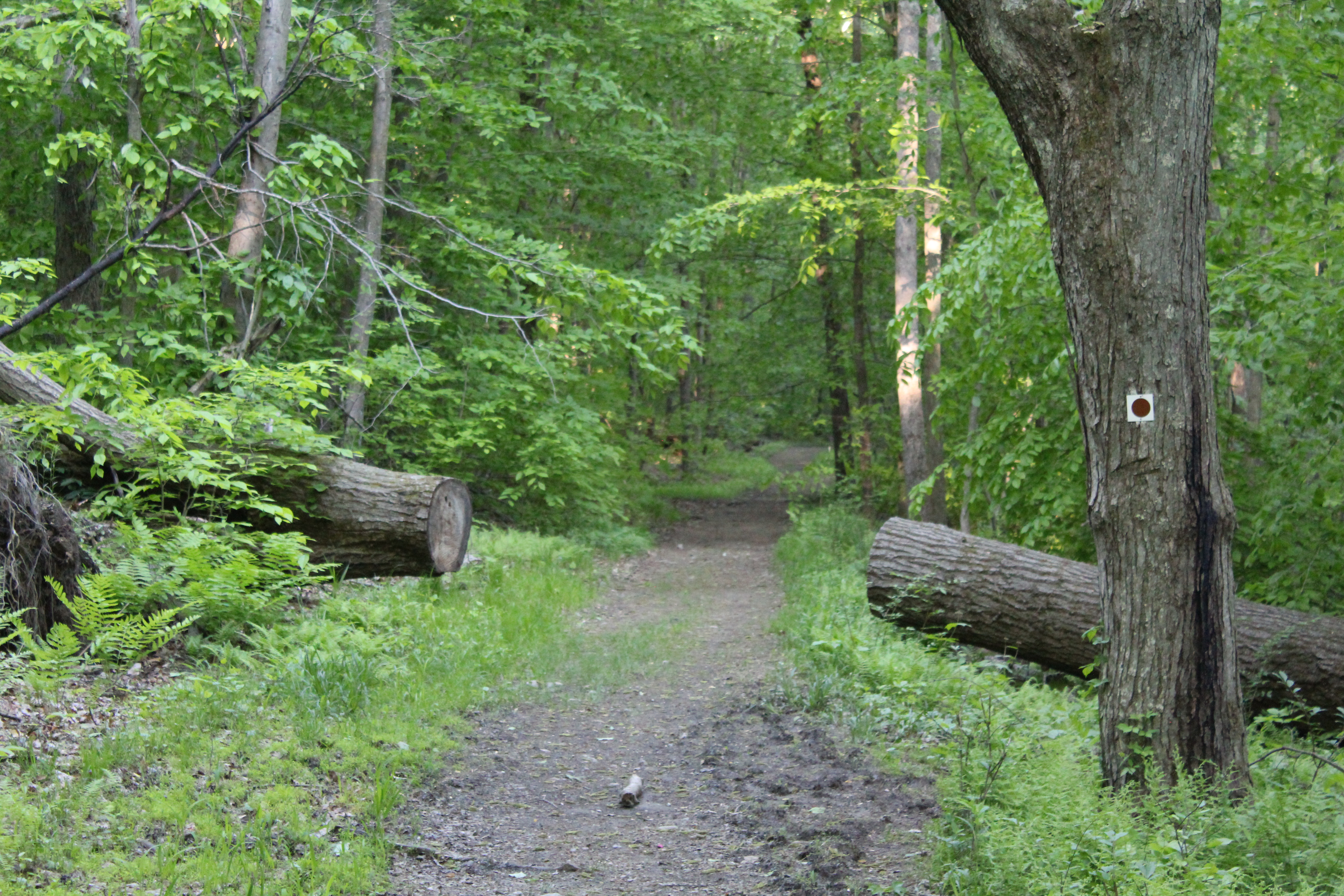
Parking alongside Route 301, the Charcoal Burners Trail makes a hasty retreat into the woods where it meets with the Perkins Trail (Y) about .1 of a mile after you start.

IMG_8958

IMG_8960

IMG_8963

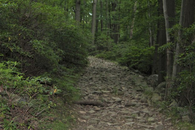
Slowly winding its way uphill, the trail snakes its way further and further away from the heavily traveled route 301.

IMG_8968

If you have never done this hike before, you will be pleasantly surprised when you come out of the woods, turn left and begin walking on grass. It is a welcome change from the usual rocks and uneven terrain that are a staple of every trail.

IMG_8972

IMG_8973

As you walk through the grass, be prepared for your boots to get wet!!!

IMG_9027

After a short distance you turn right and in front of you will be a gate. Make sure that as you make your way through this area, you stay on the trail as you will be hiking on private property.

IMG_8976

Instead of being confined to a narrow rocky trail, once you pass through the gate the entire world opens in front you. Breathtaking in its scope, a myriad of photographic opportunities await as you take a moment to reel everything in.

IMG_8978

IMG_8979

IMG_8981

IMG_8980

As you continue hiking, you will see horses on your left and cows on the right. The trail continues on some really nice terrain, and even though the grass was wet with a cool morning dew, it was somewhat better than the trails we are used to in this area.

IMG_8989

This was a great place to get some excellent pictures of the surrounding countryside. Without the summer haze that you would expect in mid July, the mountains in the distance were crystal clear. Even more interesting were the tractors, some dead and some alive, that seemed to inhabit the area. They added some nice character to the pictures that you see here.

IMG_8986

IMG_8987 (1)

IMG_8984

IMG_8992

Continuing on the grass, follow the trail markings (not hard to miss) and you will make the hard left turn.

IMG_9006 (1)


IMG_8999

IMG_9001

IMG_9007

IMG_9019

IMG_9020IMG_9021

After walking for another 10 minutes, you will eventually end up re-entering the woods. As with everything else, all good things must come to an end and the trail picks up exactly where it left off, in the woods.

IMG_9023

IMG_9024

IMG_9026

Once you get back on the trail, you will see that it  heads downhill for probably about a mile, ending at a small bridge. If you were to do this hike in reverse, you would have a pretty long climb, so if you decide to do this hike, choose your direction wisely! This is also an excellent place to stop and rest for a little bit because you have a small climb ahead of you.

IMG_9040

IMG_9041

IMG_9033

IMG_9034

After crossing Glynwood Road, the trail heads steeply up hill for approximately 1/4 of a mile and then turns on to a dirt where you will stay until it heads deeper into the woods.

IMG_9043

As the trail gradually slopes downward, you will see a lake to your right. Now  marked by Blue Blazes, this will continue to be the color of the blaze that you will follow for almost the rest of the hike.

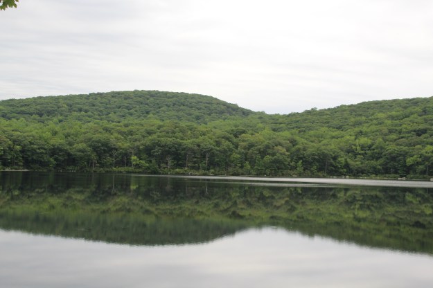
As the trail winds around the lake, it begins a slow ascent back to the Charcoal Burners Trail where, one mile from the end of the hike, you can rest for a final time at yet another lake.

After you rest and get some good photos, cross the bridge and follow the blue blazes until they turn left. You will stay on the red Charcoal Burners trail until you reach Route 301.

IMG_9061

Overall this hike is 6 miles long. Technically it isn’t a very difficult hike, but it does offer a couple of small climbs that will get your heart pumping. As you can tell by the pictures, it does, however, offer a wide range of scenery that will allow you to get some excellent photos.

Peace and happy hiking!!